Erik the Black's Tahoe Rim Trail Maps and Guide Books
From the Author: My Tahoe Rim Trail Maps and Pocket Atlases are designed to give you the essential trail data you need to plan your hike and navigate the TRT, in a hiker-friendly format. If you like to know where you’re going, but don’t like packing heavy guide books and maps, then my minimalist trail guides are for you!

Happy trails,
Author of Tahoe Rim Trail Maps
Tahoe Rim Trail Maps and Essential Data For Hiking, Biking and Riding The 171 Mile TRT Around Lake Tahoe, Packed Into One Ultralight Pocket Guide Book

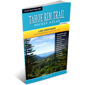
Erik the Black’s Tahoe Rim Trail Pocket Atlas
Lake Tahoe Basin, 2nd Edition
- Ultralight Pocket Guidebook: TRT Pocket Atlas measures 4.5 x 7.5 x 0.1 inches and weighs just 2 ounces
- Tahoe Rim Trail Maps: Showing the entire trail, water sources, campsites, trailheads and points of interest
- Mileage and Elevation Data: Including clockwise and counterclockwise mileage and detailed elevation profiles
- Resupply Locations and Services: Post offices, maildrops, transportation, food, lodging, outfitters and more
- Downloadable GPS Data: For use with your smartphone and GPS devices (GPX format)
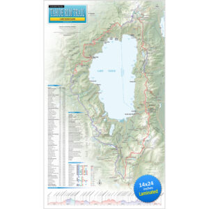
Tahoe Rim Trail Map Showing The Entire 171 Mile TRT Around Lake Tahoe, With Essential Information For Hikers, Mountain Bikers and Equestrians

Erik the Black’s Tahoe Rim Trail Wall Map (Laminated)
15 x 26 inches, 4th Edition
- Tahoe Rim Trail Overview Map: Showing the entire 171 mile Tahoe Rim Trail route around Lake Tahoe
- Mileage and Elevation Data: For important junctions, waypoints and points of interest along the way
- Elevation Profile: Showing all the peaks, passes and valleys along the Tahoe Rim Trail route
- Side Trails and Alternate Routes: Linking the TRT with trail towns and nearby places of interest
- Resupply Locations: Trail towns, post offices, maildrops and hiker services near the Tahoe Rim Trail
Ready to Start Planning Your Tahoe Rim Trail Hike?
Order your Tahoe Rim Trail Maps and Guide Books here
-
Sale!
Erik the Black’s Tahoe Rim Trail Pocket Atlas
Original price was: $29.95.$24.95Current price is: $24.95. -
Sale!
Erik the Black’s Tahoe Rim Trail Wall Map (Laminated)
Original price was: $29.95.$21.95Current price is: $21.95. -
Sale!
Erik the Black’s Tahoe Rim Trail Map Bundle
Original price was: $49.95.$39.95Current price is: $39.95.
TRAIL MAPS
POCKET ATLASES
GEAR LISTS
BlackwoodsPress.com
Copyright © 2026 by Erik Asorson