Tahoe Rim Trail Map Bundle: All The Maps & Essential Trail Data You Need To Hike, Bike or Ride The 171 Mile Tahoe Rim Trail (20% Discount!)


Tahoe Rim Trail Map Bundle
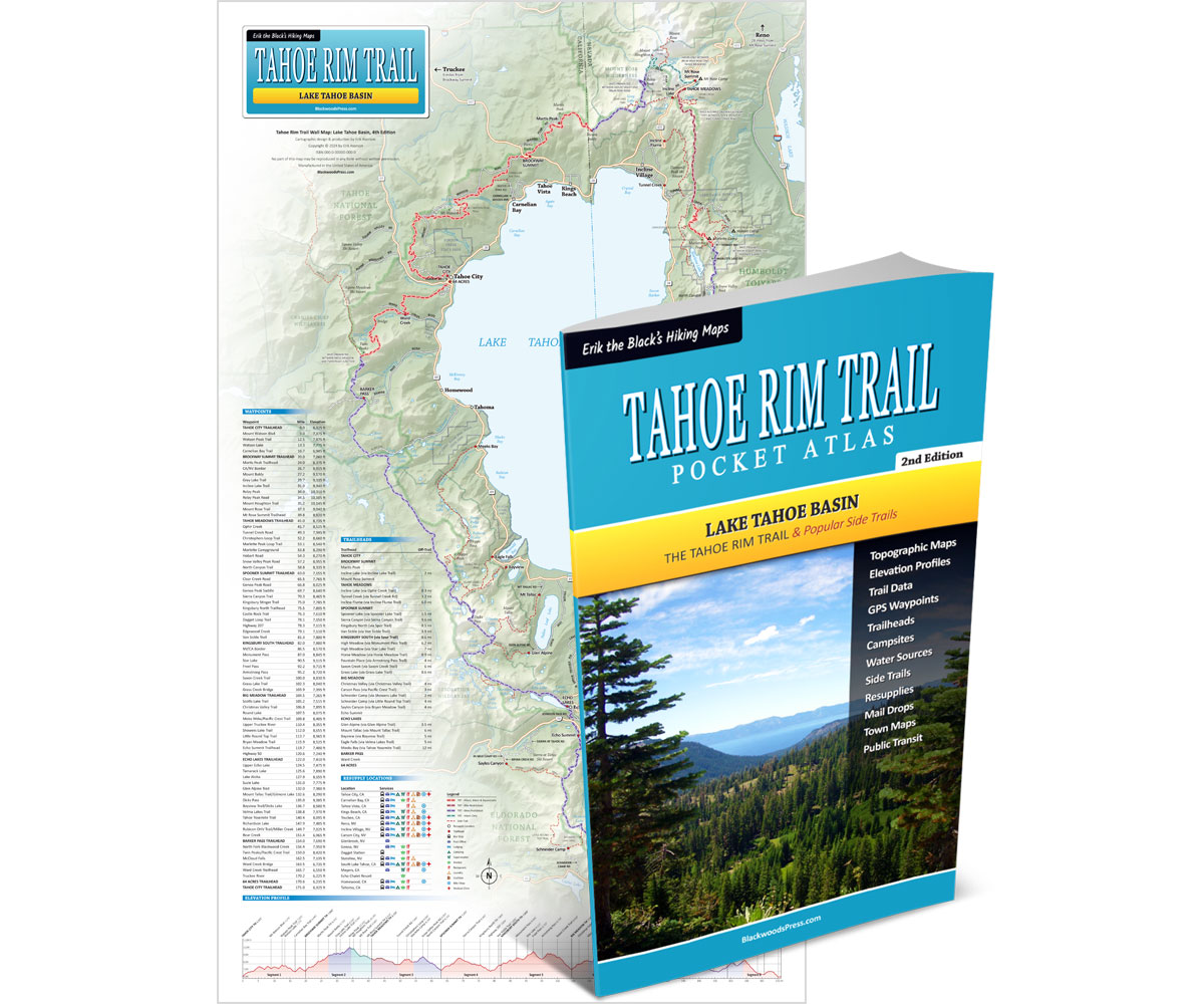
Pocket Atlas & Wall Map
By “Erik the Black” Asorson
- Tahoe Rim Trail Pocket Atlas, 2nd Edition: All the maps and essential trail data you need to hike, bike or ride the 171 mile Tahoe Rim Trail around Lake Tahoe (packed into one pocket-size guidebook that weighs just 2 ounces)
- 14 x 24 inch Laminated Wall Map: Detailed overview of the entire 171 mile Tahoe Rim Trail route around Lake Tahoe (with mileage, elevation, trailheads, resupply towns and essential trail data)
Product Details
Title: Tahoe Rim Trail Map Bundle: Pocket Atlas & Wall Map
Publisher: Blackwoods Press, 2nd edition
Pocket Atlas: 32 pages
Wall Map: 14 x 24 inches (laminated)
Weight: 4.4 ounces
ISBN: 978-1-7367279-7-3
Original price was: $49.95.$39.95Current price is: $39.95.
You Save: $10.00 (20%)
Also available from Amazon.com
30 day money back satisfaction guarantee
FREE SHIPPING: USPS Ground (3-7 business days)
From the Author: My Tahoe Rim Trail Map Bundle includes: Tahoe Rim Trail Pocket Atlas (2nd Edition) and Tahoe Rim Trail Wall Map (14 x 24 inch, Laminated.) Everything you need to plan your trip and hike, bike or ride the 171 mile Tahoe Rim Trail around Lake Tahoe (plus a 20% discount!)

Happy trails,
Cartographer, TRT Thru-hiker
Tahoe Rim Trail Maps & The Essential Trail Data You Need To Hike, Bike or Ride The 171 Mile Trail Around Lake Tahoe… In One Pocket-Size Book!
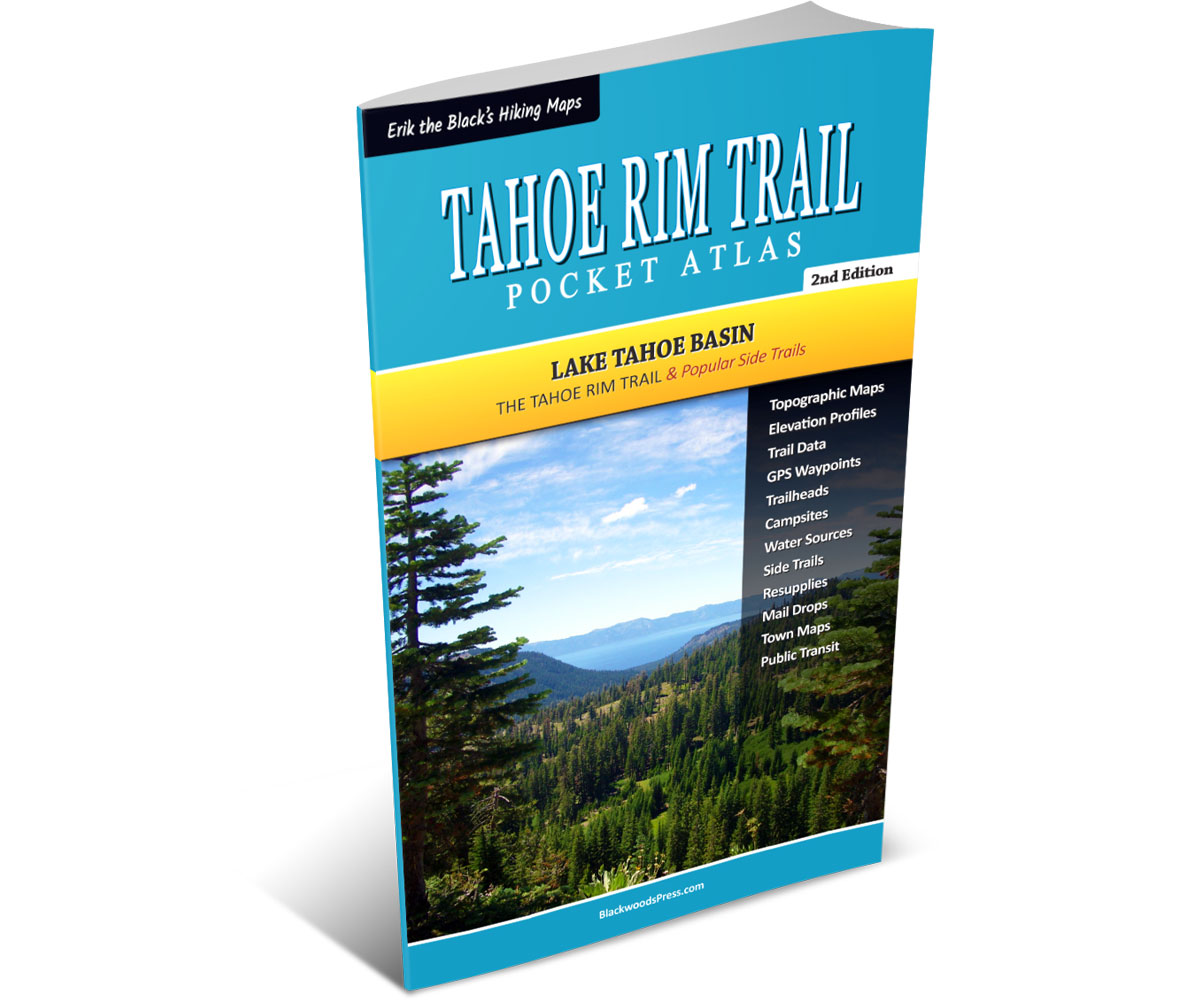
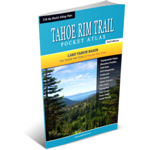
Tahoe Rim Trail Pocket Atlas
Paperback, 2nd Edition
- Pocket-Size Guidebook: Tahoe Rim Trail Pocket Atlas measures 4.5 x 7.5 x 0.1 inches and weighs just 2 ounces
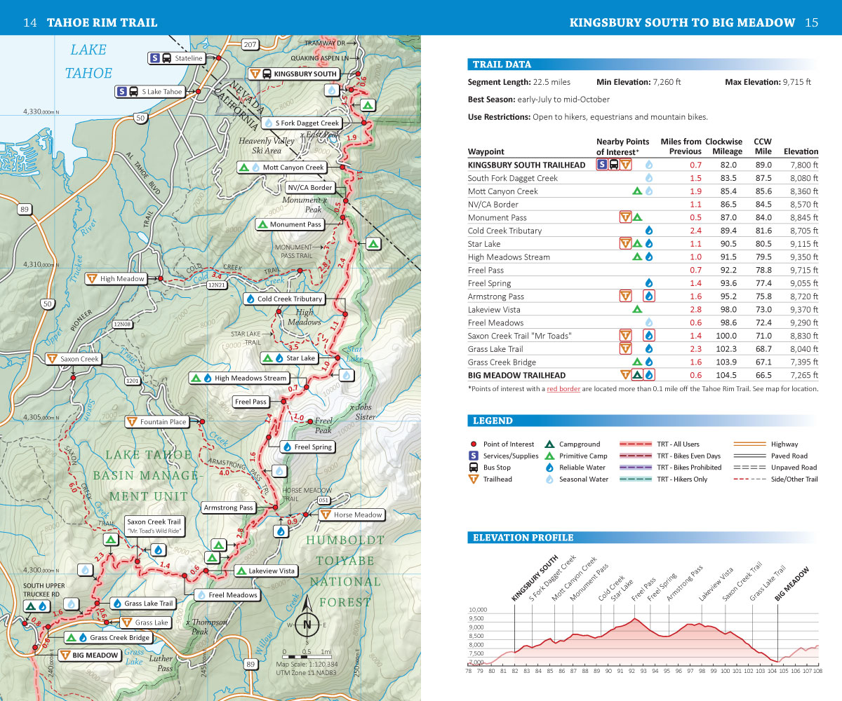
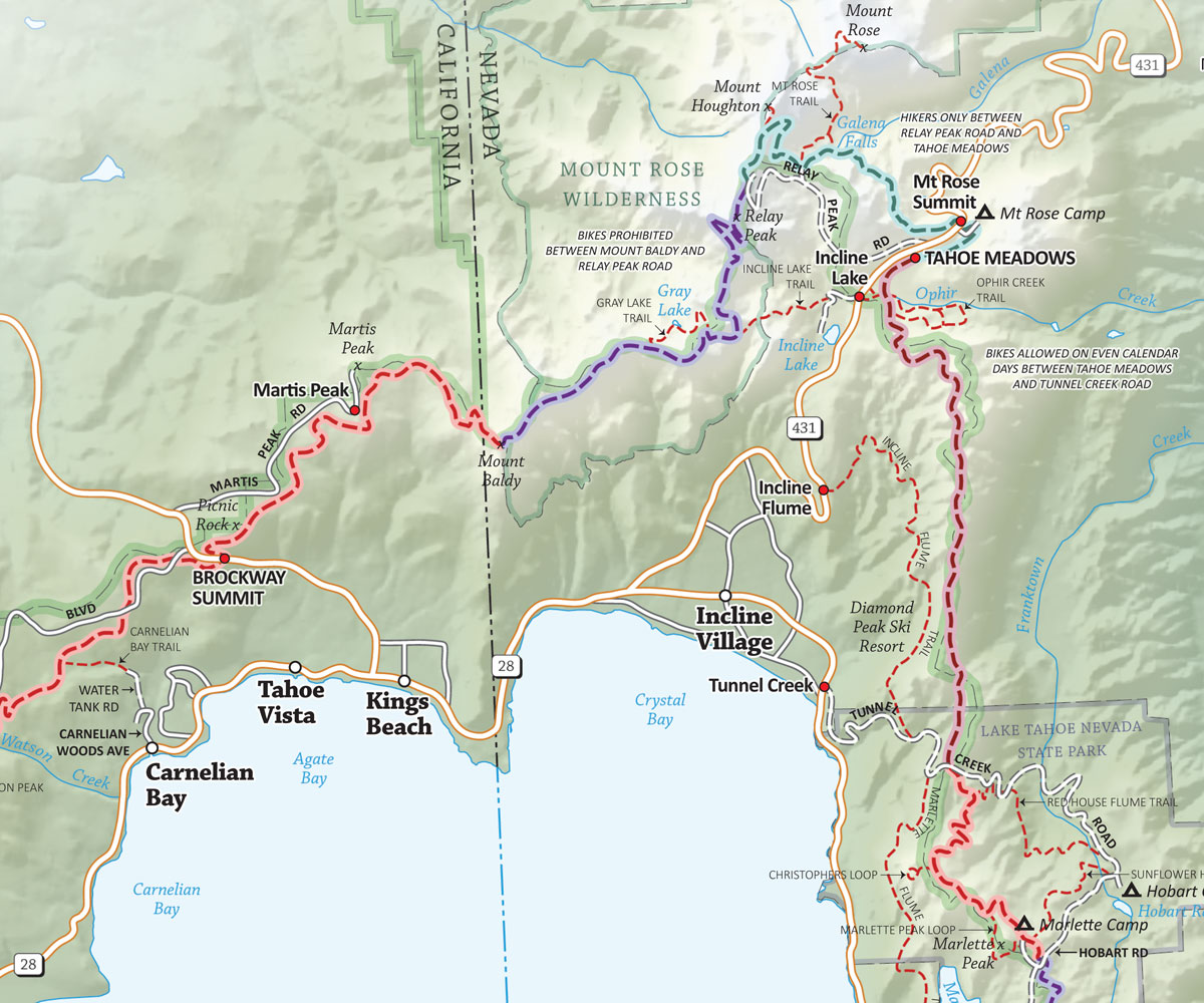
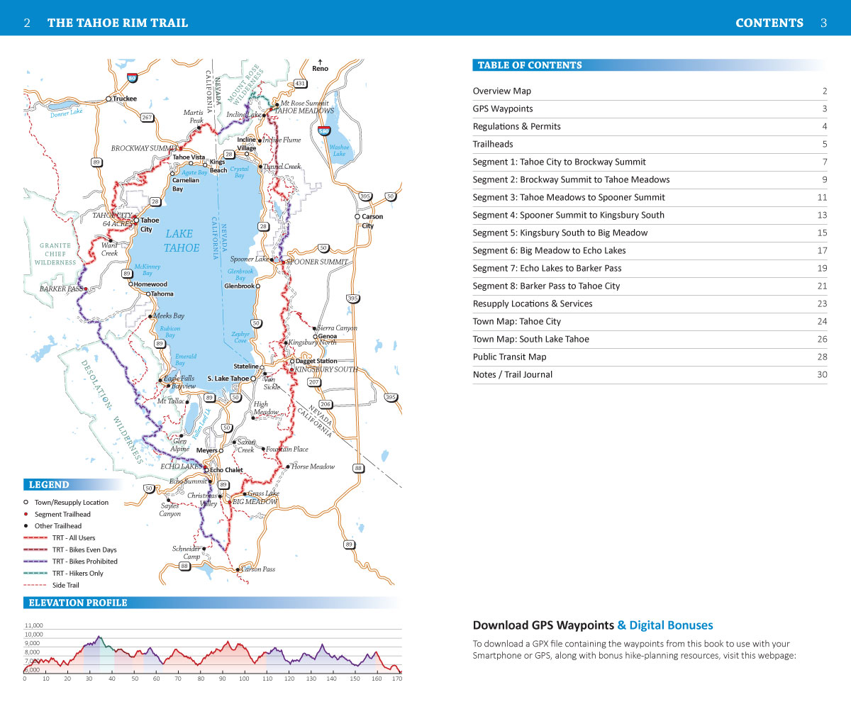
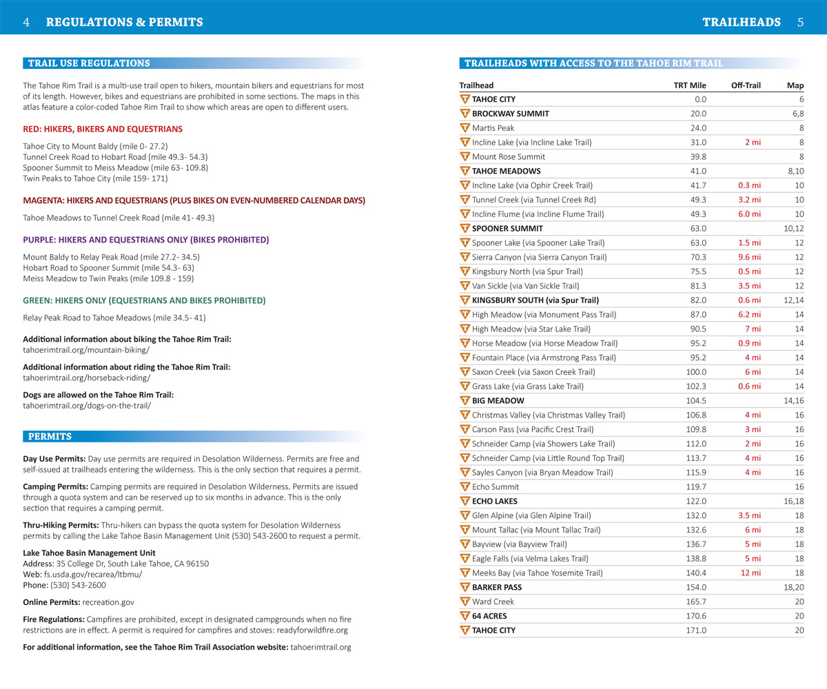
- Tahoe Rim Trail Maps: Detailed maps for the entire 171 mile trail (plus side trails and alternate routes)
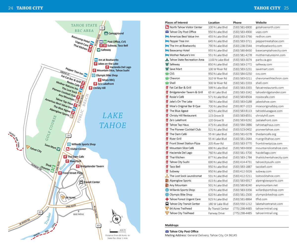
- Points of Interest: Campsites, water sources, trailheads and other important features marked on the maps
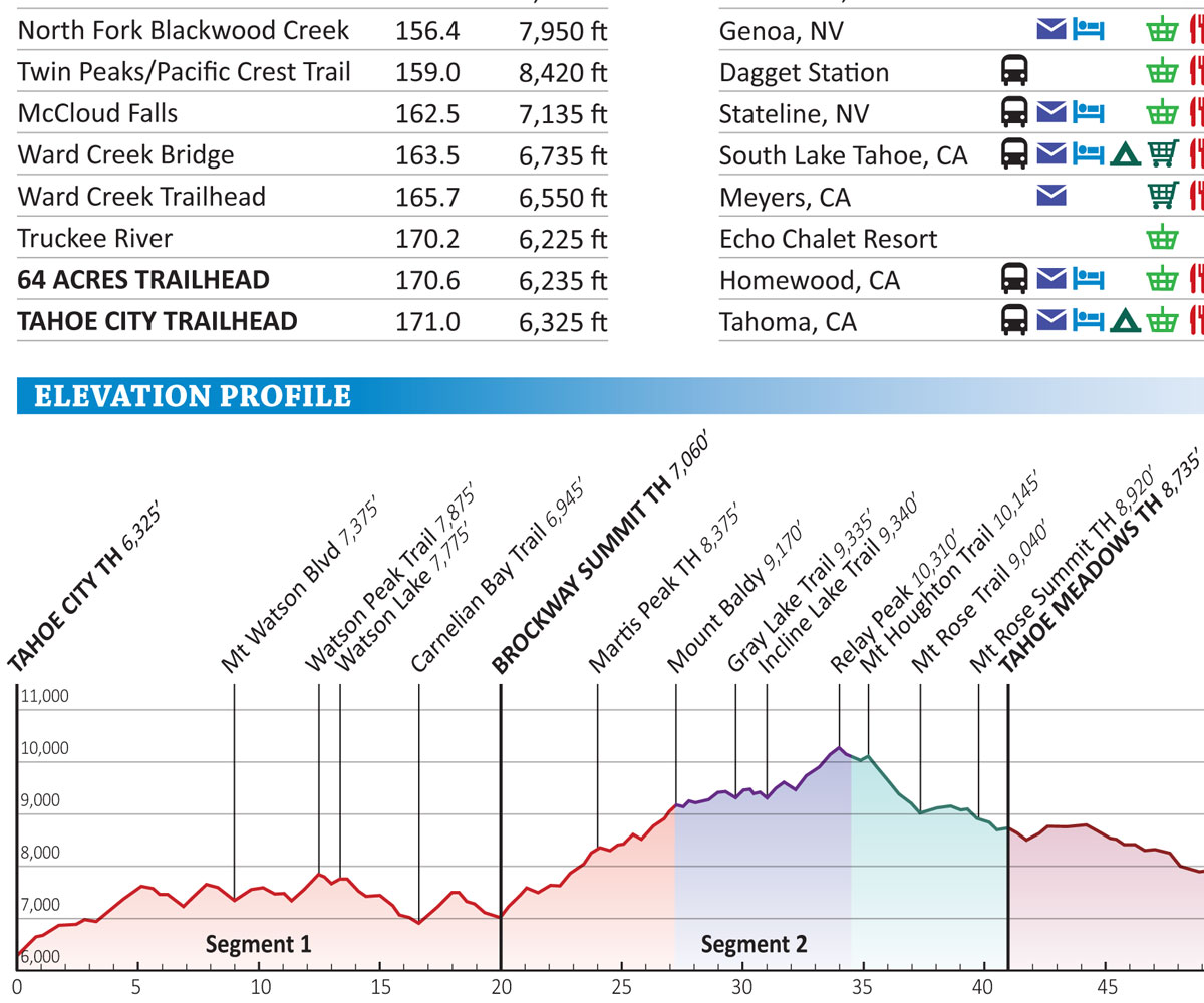
- Mileage and Elevation Data: For important waypoints and points of interest along the Tahoe Rim Trail
- Elevation Profiles: See all the peaks, passes and valleys along the route, so you can plan for the big climbs
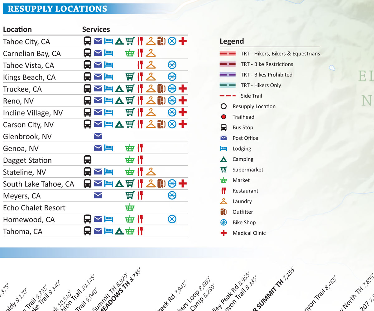
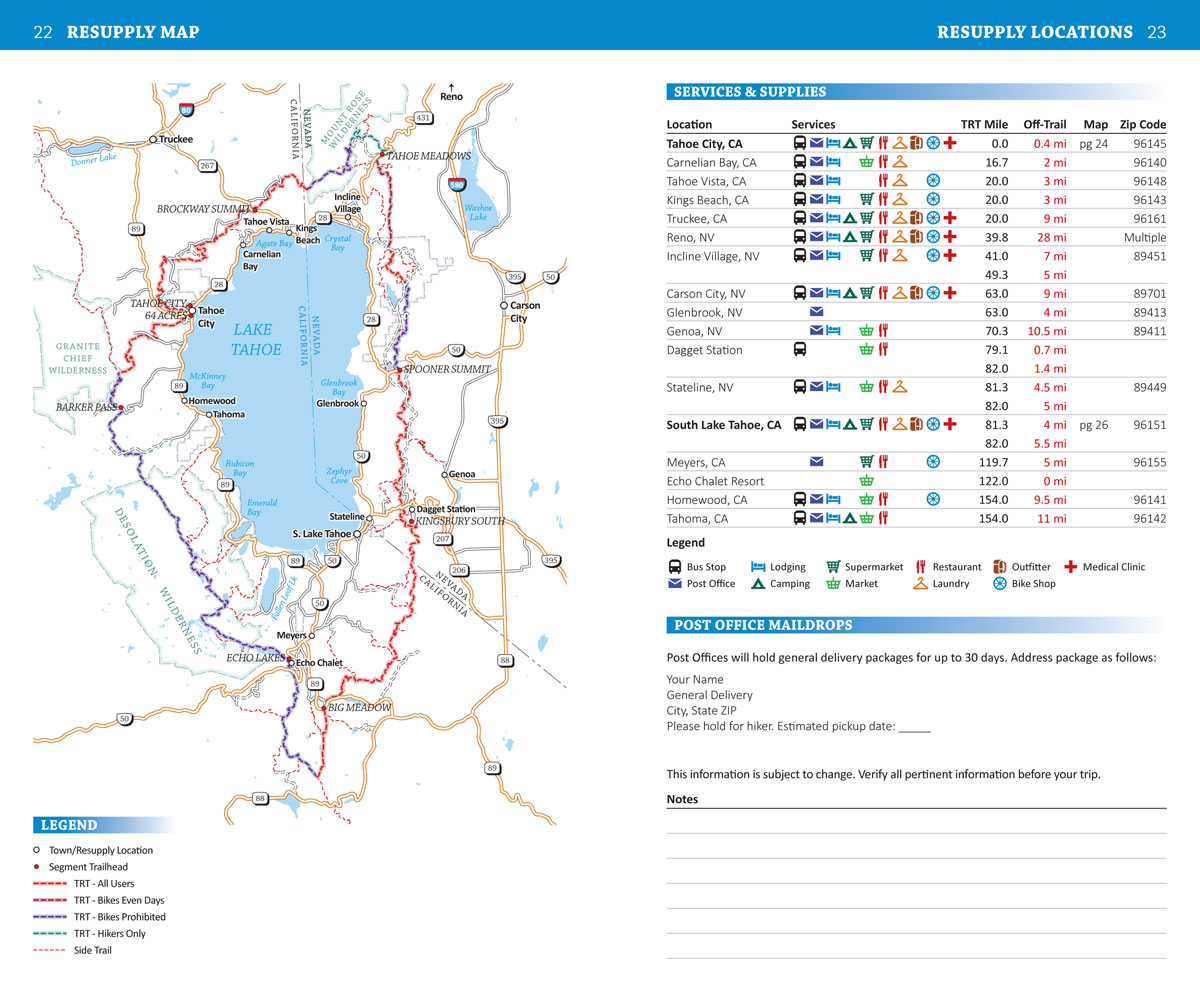
- Resupply Guide: Trail towns, resupply locations, maildrops and hiker services near the Tahoe Rim Trail
- GPS Data: Download a GPX file with the waypoints from the book to use with your Smartphone or GPS
Product Details
Title: Tahoe Rim Trail Pocket Atlas
Publisher: Blackwoods Press, 2nd edition
Paperback: 32 pages
Dimensions: 4.5 x 7.5 x 0.1 inches
Weight: 1.7 ounces
ISBN: 978-1-7367279-0-4
A Detailed Overview Map Of The 171 Mile Tahoe Rim Trail Around Lake Tahoe (With Essential Trail Data To Help You Plan Your Hike)
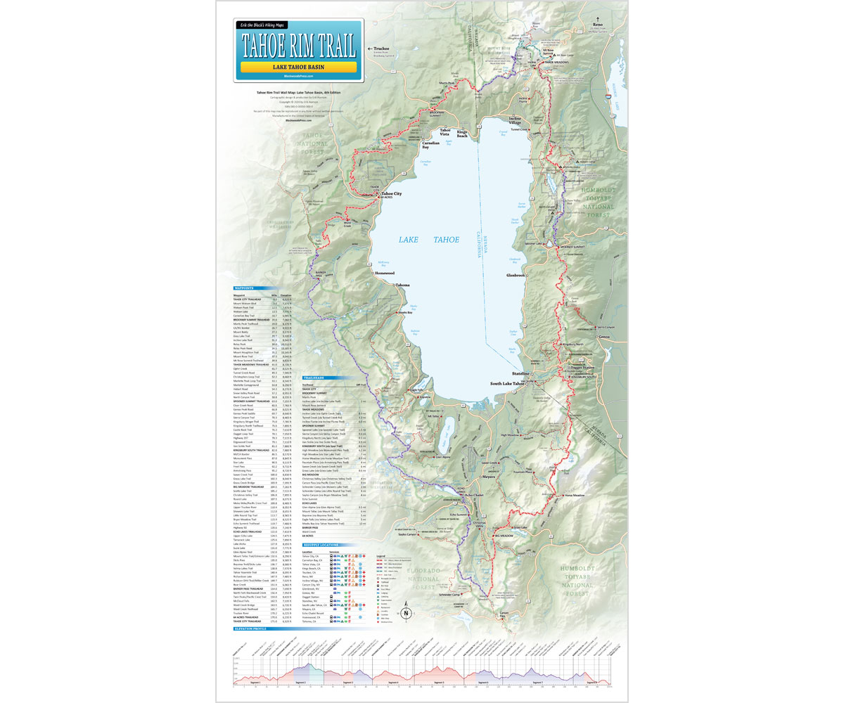

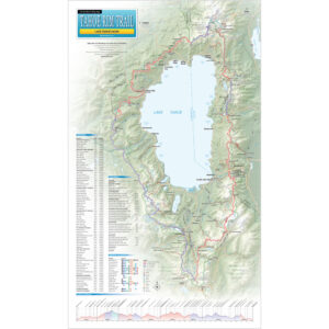
Tahoe Rim Trail Wall Map
14 x 24 inch (Laminated)
- 14 x 24 inch Laminated Wall Map: Showing the entire 171 mile Tahoe Rim Trail around Lake Tahoe
- Mileage and Elevation Data: For important waypoints and points of interest along the Tahoe Rim Trail
- Elevation Profile: See all the peaks, passes and valleys along the route, so you can plan for the big climbs
- Resupply Guide: Trail towns, resupply locations, maildrops and hiker services near the Tahoe Rim Trail
Product Details
Title: Tahoe Rim Trail Wall Map (Laminated)
Publisher: Blackwoods Press, 4th edition
Dimensions: 14 x 24 inches
Item Weight: 2.7 ounces
ISBN: 978-1-7367279-3-5
Start Planning Your Tahoe Rim Trail Adventure!
Order Your Tahoe Rim Trail Map & Pocket Atlas Here:

Tahoe Rim Trail Map Bundle
Pocket Atlas & Wall Map
Original price was: $49.95.$39.95Current price is: $39.95.
You Save: $10.00 (20%)
Also available from Amazon.com
30 day money back satisfaction guarantee
FREE SHIPPING: USPS Ground (3-7 business days)