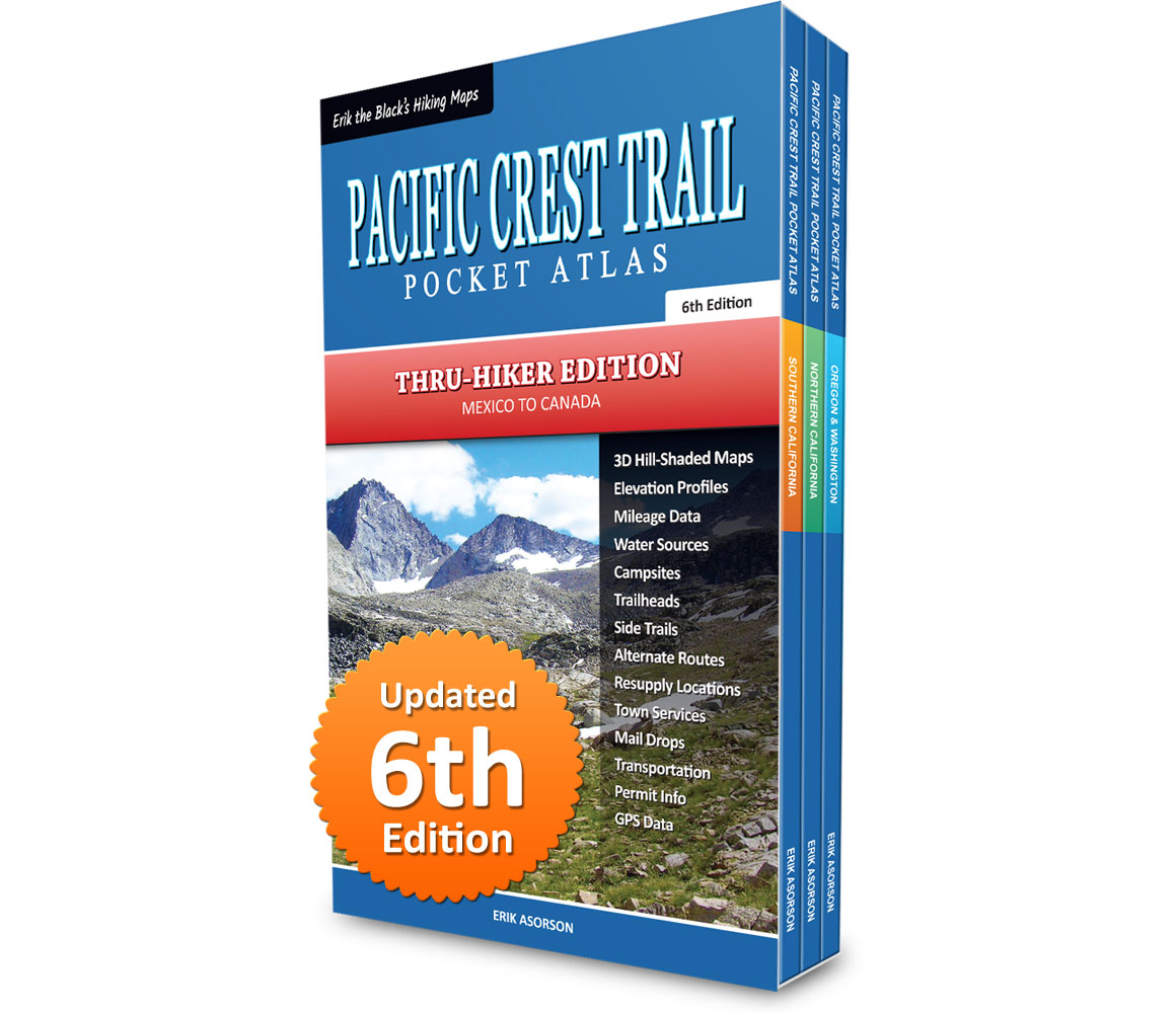
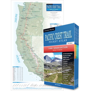
Pacific Crest Trail Pocket Atlas: Complete 3-Book Set
Mexico to Canada, 6th Edition
By Erik Asorson (Erik the Black)
- Three Pocket-Size Guide Books: Each Pocket Atlas measures 4.25 x 7 inches and weighs less than 3 ounces
- Pacific Crest Trail Maps: Showing the entire PCT route, water sources, campsites, trailheads and points of interest
- Mileage and Elevation Data: Including northbound and southbound mileage and detailed elevation profiles
- Resupply Locations and Services: Post offices, maildrops, transportation, food, lodging, outfitters and more
- Downloadable GPS Data: Waypoints and tracks for your smartphone and GPS devices (GPX format)
Original price was: $89.95.$49.95Current price is: $49.95.
FREE SHIPPING!
Also available from:
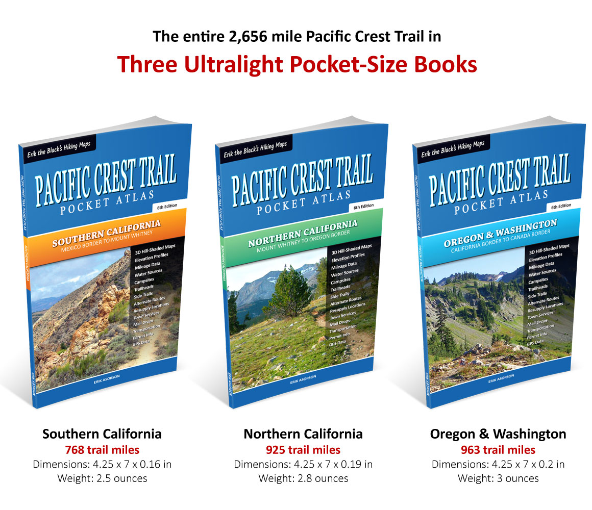
The entire 2,656 mile Pacific Crest Trail in three ultralight
Pocket-Size Pacific Crest Trail Guide Books

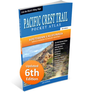
Southern California
Mexico to Mount Whitney
768 trail miles
Dimensions: 4.25 x 7 x 0.16 in
Weight: 2.5 ounces
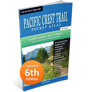
Northern California
Mount Whitney to Oregon
925 trail miles
Dimensions: 4.25 x 7 x 0.19 in
Weight: 2.8 ounces
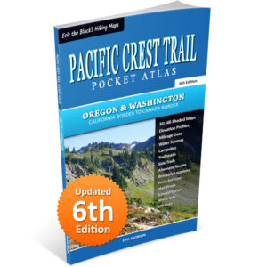
Oregon & Washington
California to Canada
963 trail miles
Dimensions: 4.25 x 7 x 0.2 in
Weight: 3 ounces
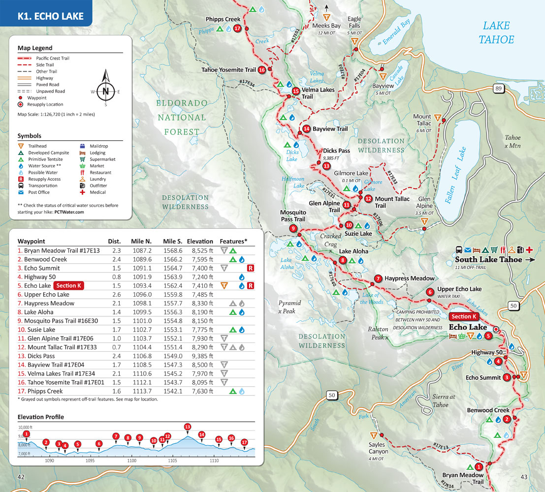
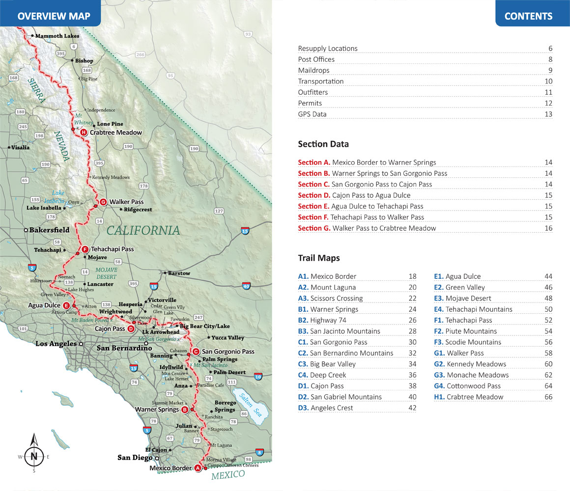
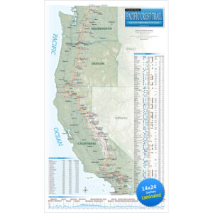
Pacific Crest Trail Maps
Pacific Crest Trail Maps for the entire 2,656 mile Pacific Crest Trail from Mexico to Canada, with important waypoints, mileage and elevation data, side trails and alternate routes, essential water sources, campsites, trailheads and resupply locations.


Pacific Crest Trail Data
Essential information to help you plan your hike: Northbound and southbound mileage, elevation profiles, best times of year for each section, resupply locations, town services, maildrops, public transportation, permit info, downloadable GPS data and more.


Start Planning Your Pacific Crest Trail Hike
Get Your Pacific Crest Trail Pocket Atlas Here:
Pacific Crest Trail Pocket Atlas: Complete 3-Book Set
Mexico to Canada, 6th Edition
Original price was: $89.95.$49.95Current price is: $49.95.
30 day money back satisfaction guarantee
FREE SHIPPING!
Also available from:
From the Author: My Maps and Pocket Atlases for the Pacific Crest Trail, John Muir Trail, Tahoe Rim Trail, Colorado Trail and Arizona Trail are designed to give you the essential trail data you need to plan your hike and navigate the trail, in a hiker-friendly format. If you like to know where you’re going, but don’t like packing heavy guidebooks and maps, then my minimalist trail guides are for you!

Happy trails,
Founder of Blackwoods Press
Related products
-
Sale!
Pacific Crest Trail Map Bundle
Original price was: $99.95.$64.95Current price is: $64.95. -
Sale!
Pacific Crest Trail Wall Map
Original price was: $29.95.$24.95Current price is: $24.95. -
Sale!
Pacific Crest Trail Pocket Atlas: Oregon & Washington
Original price was: $29.95.$24.95Current price is: $24.95. -
Sale!
Pacific Crest Trail Pocket Atlas: Southern California
Original price was: $29.95.$24.95Current price is: $24.95. -
Sale!
Pacific Crest Trail Pocket Atlas: Northern California
Original price was: $29.95.$24.95Current price is: $24.95.