Pacific Crest Trail Maps & The Essential Trail Data You Need To Hike The 2,650 Mile Trail From Mexico to Canada… In Three Pocket-Size Books!
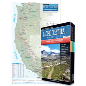
Pacific Crest Trail Pocket Atlas
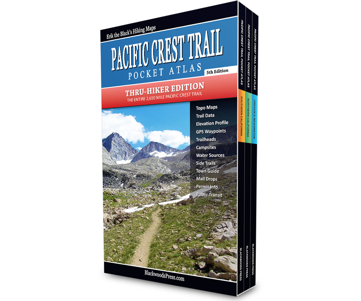
Complete 3-Book Set
By “Erik the Black” Asorson
Original price was: $89.95.$49.95Current price is: $49.95.
Save: $40.00 (44%)
FREE SHIPPING: USPS Ground (3-7 business days)
Features
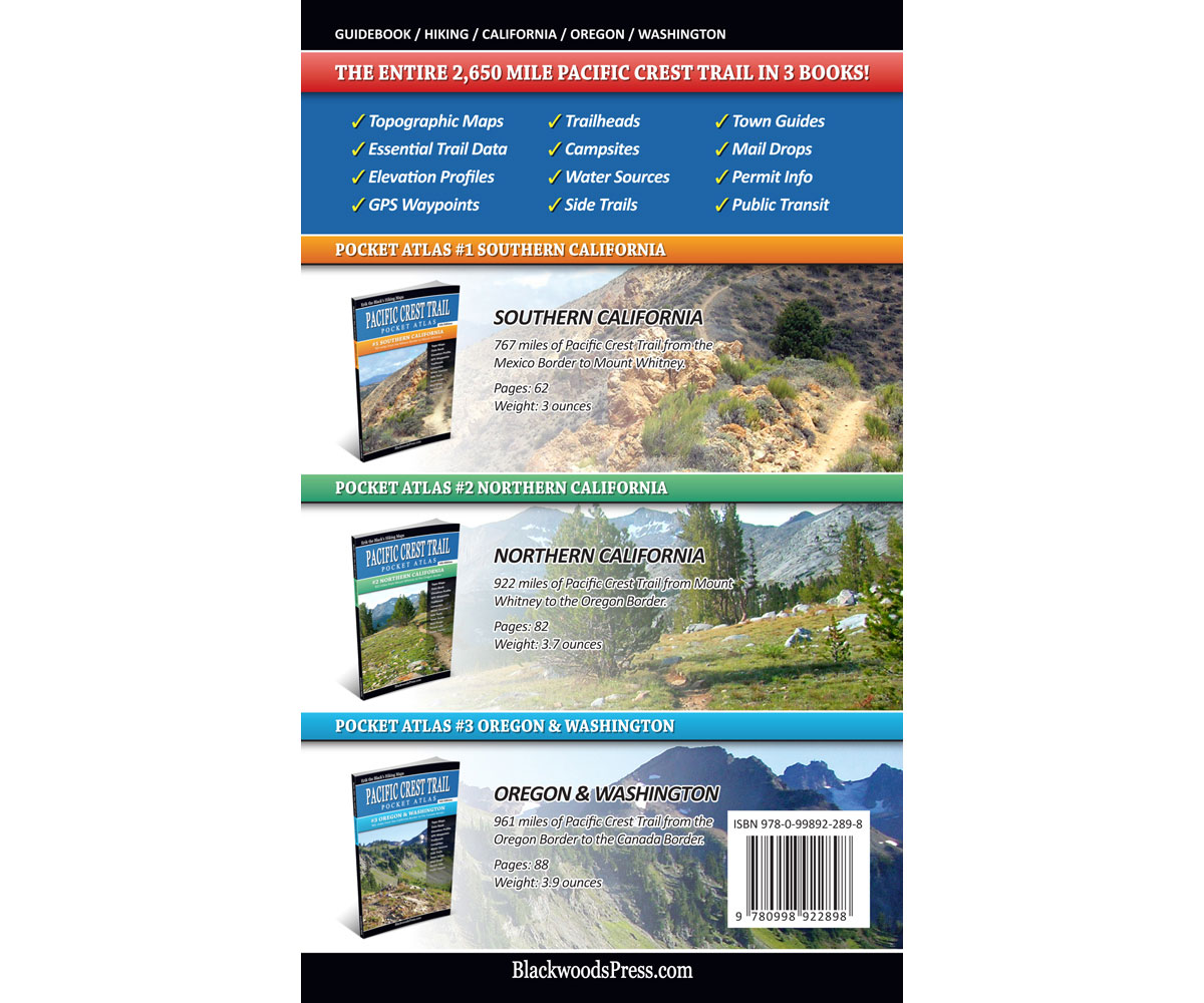
- Complete 3-Book Set: The entire 2,650 mile Pacific Crest Trail from Mexico to Canada in three pocket-size books
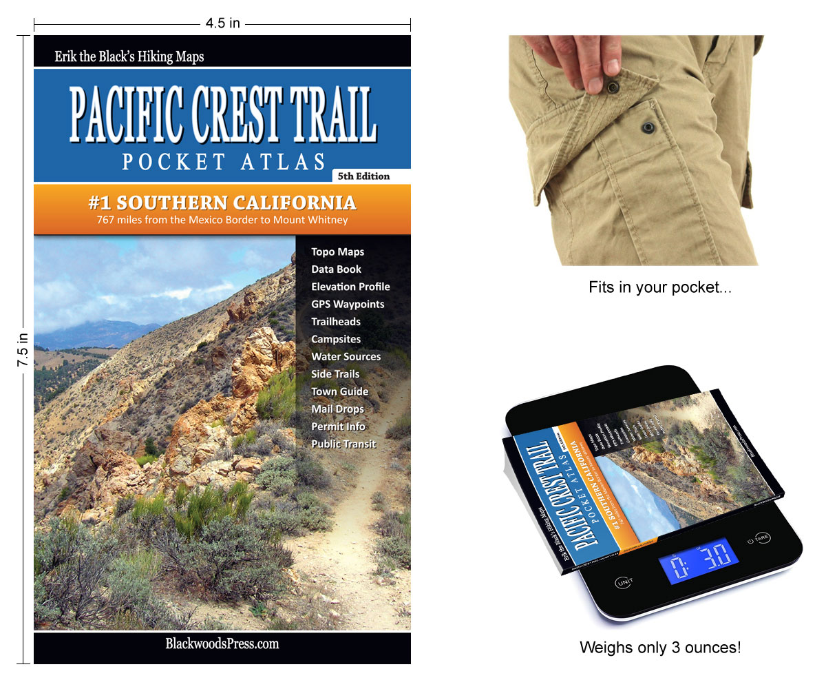
- Pocket-Size Guidebooks: Each book covers 750+ miles, measures 4.5 x 7.5 inches and weighs just 3 ounces
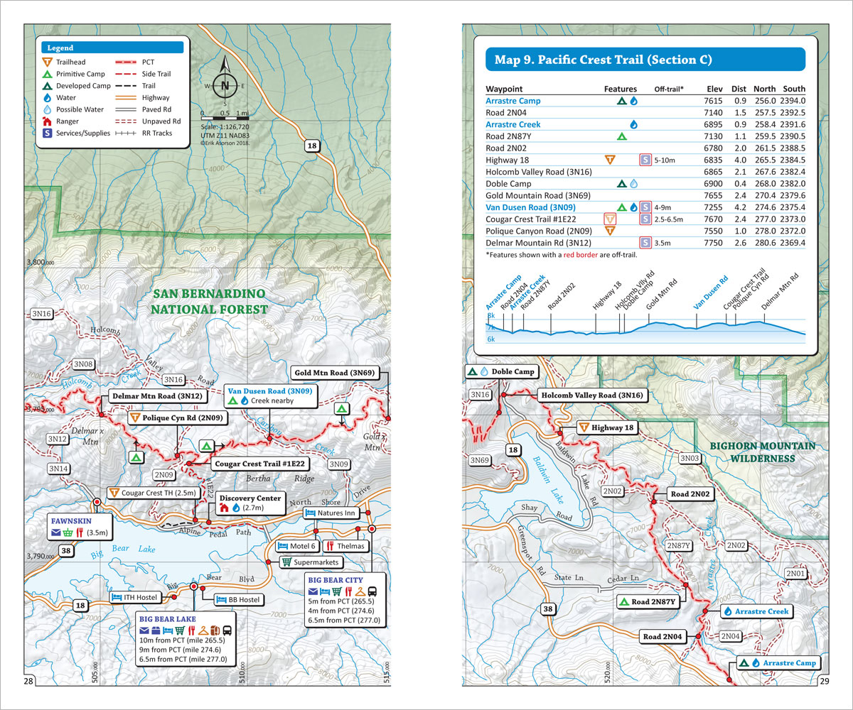
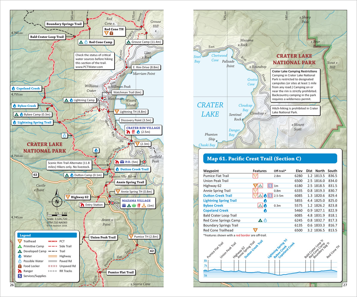
- Pacific Crest Trail Maps: Detailed maps for the entire 2,650 mile trail (plus side trails and alternate routes)
- Points of Interest: Campsites, water sources, trailheads and other important features marked on the maps
- Mileage and Elevation Data: For important waypoints and points of interest along the Pacific Crest Trail
- Elevation Profiles: See all the peaks, passes and valleys along the route, so you can plan for the big climbs
- Resupply Guide: Trail towns, resupply locations, maildrops and hiker services near the Pacific Crest Trail
- GPS Data: Download a GPX file containing the waypoints from the book, to use with your Smartphone or GPS
Product Details
Title: Pacific Crest Trail Pocket Atlas: 3-Book Set
Publisher: Blackwoods Press, 5th edition
Paperback: 232 pages
Dimensions: 4.5 x 7.5 x 0.5 inches
Weight: 9.8 ounces
ISBN: 978-0-9989228-9-8
From the Author: My Pacific Crest Trail Pocket Atlas packs all the maps and essential trail data you need to hike the Pacific Crest Trail from Mexico to Canada into three pocket-size booklets. If you like to know where you’re going, but don’t like heavy guidebooks or big floppy maps, then these minimalist PCT guides are for you!

Happy trails,
Author, Cartographer, Thru-hiker
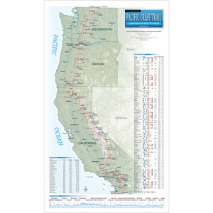
Pacific Crest Trail Maps With Mileage & Elevation Data
Plus: Water Sources, Campsites, Trailheads & More

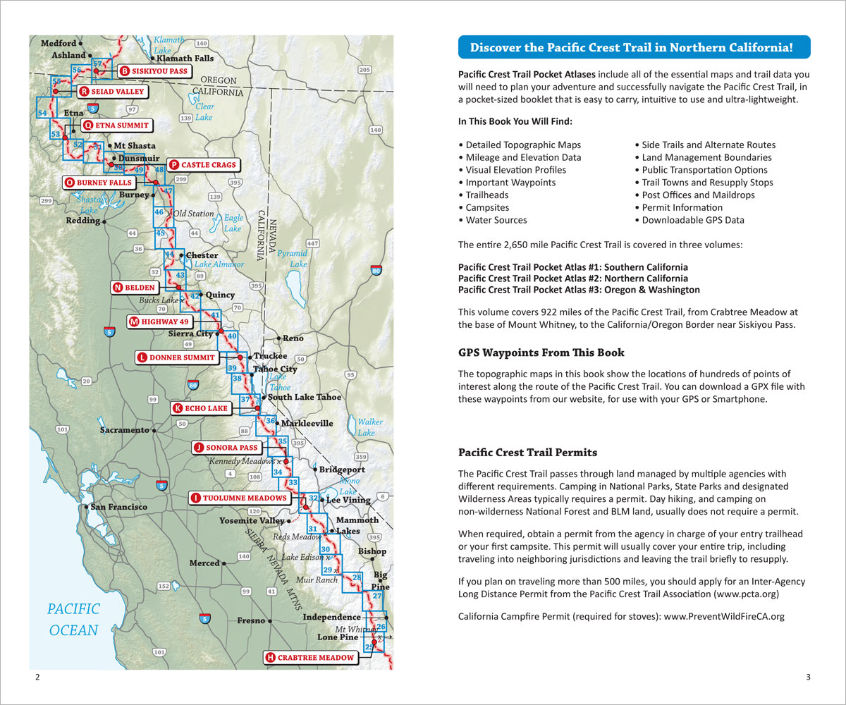
Erik the Black’s Pacific Crest Trail Maps show the entire 2,650 mile Pacific Crest Trail from Mexico to Canada, annotated with mileage and elevation data for hundreds of important waypoints and points of interest – in an easy to read two-page format.
Plus Essential Information To Help You Plan Your Hike
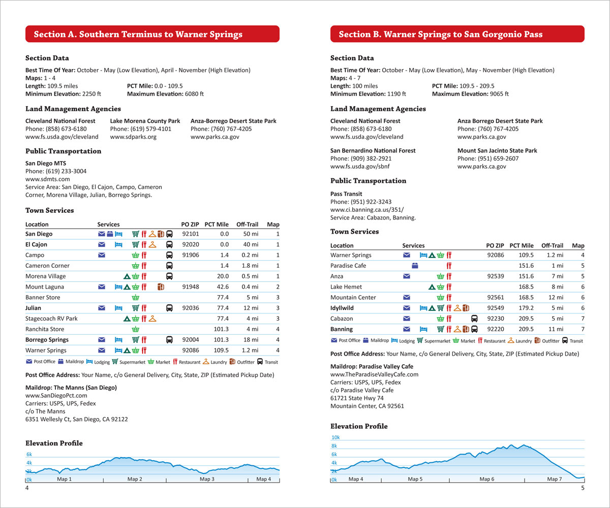
Section Data, Resupply Guide, Public Transit, Permits & More
Pacific Crest Trail Pocket Atlas includes planning information for all 29 sections of the PCT: Mileage and elevation data, best times of year to hike, permit requirements, public transportation, resupply locations, town services, maildrops and more.
All Packed Into Three Pocket-Size PCT Guidebooks
Each Book Measures 4.5 x 7.5 in. and Weighs Just 3 ounces
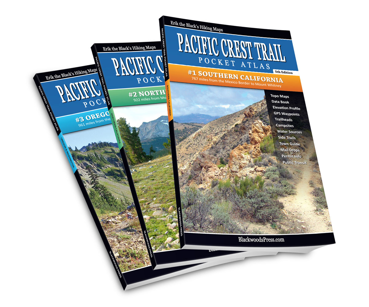
The entire 2,650 mile Pacific Crest Trail is covered in three pocket-size guidebooks:
- Pacific Crest Trail Atlas #1: Southern California covers 767 miles from the Mexico border to Mount Whitney
- Pacific Crest Trail Atlas #2: Northern California covers 922 miles from Mount Whitney to the Oregon border
- Pacific Crest Trail Atlas #3: Oregon & Washington covers 961 miles from the California border to Canada
Each Pacific Crest Trail Pocket Atlas measures 4.5 x 7.5 x 0.2 inches and weighs just 3 ounces. They are lightweight, easy to pack and contain all the maps and essential data you will need to plan your hike and successfully navigate the Pacific Crest Trail.
Start Planning Your Pacific Crest Trail Adventure!
Order Your Pacific Crest Trail Pocket Guides Here:

Pacific Crest Trail Pocket Atlas
Complete 3-Book Set, 5th Edition
Original price was: $89.95.$49.95Current price is: $49.95.
Save: $40.00 (44%)
30 day money back satisfaction guarantee
FREE SHIPPING: USPS Ground (3-7 business days)