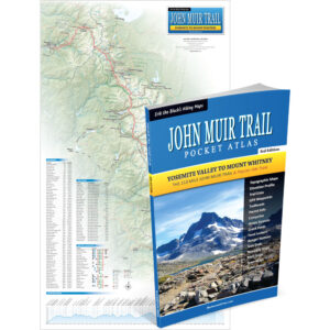
John Muir Trail Wall Map
15 x 26 inch Laminated, 4th Edition
By Erik Asorson (Erik the Black)
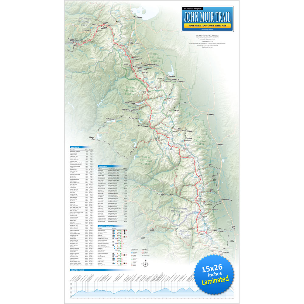
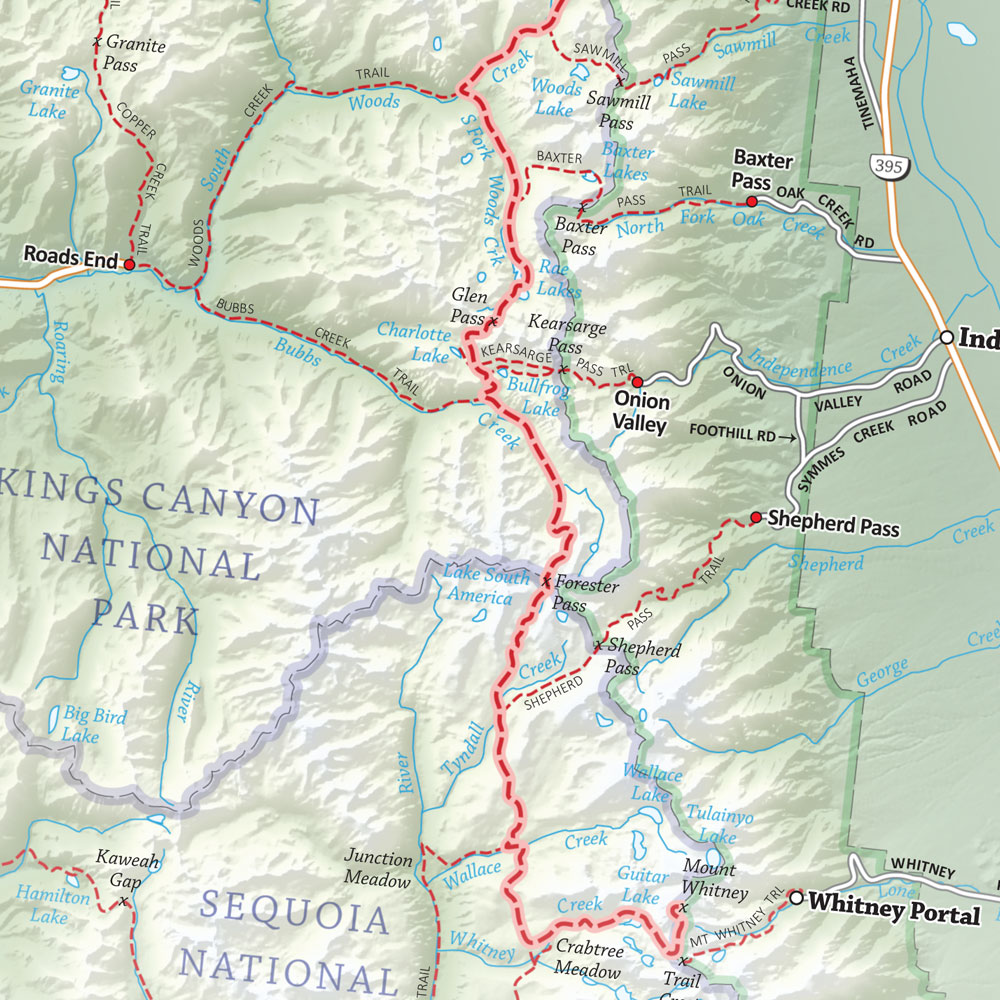
- John Muir Trail Map: A detailed overview of the entire 210 mile John Muir Trail from Yosemite to Mount Whitney
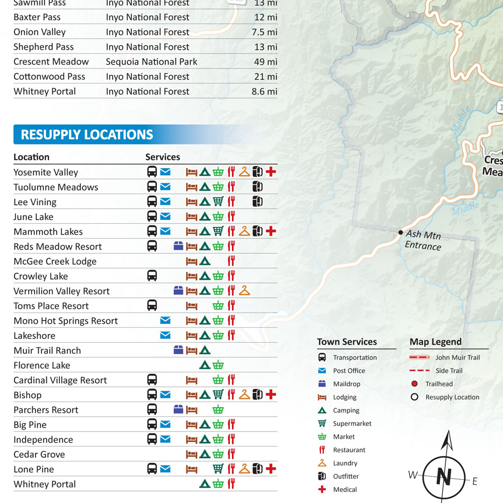
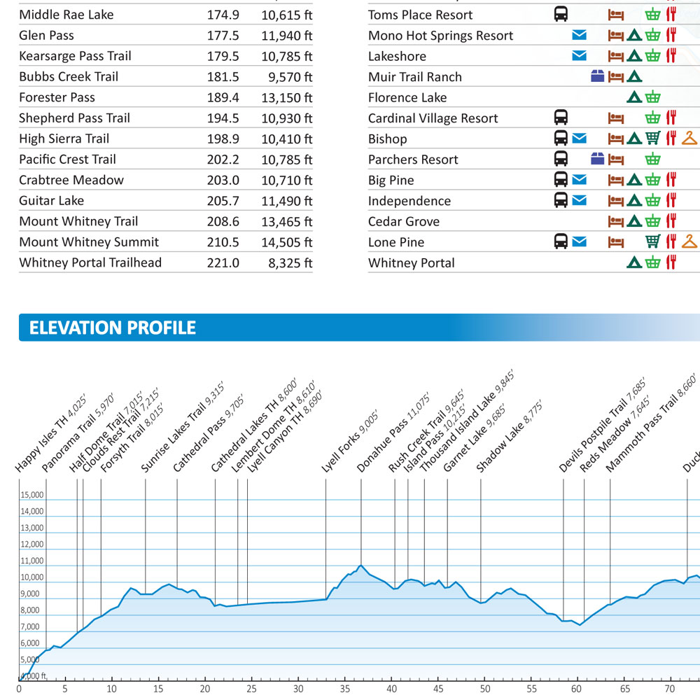
- Mileage and Elevation Data: For important junctions, waypoints and points of interest along the route
- Elevation Profile: Showing all the peaks, passes and valleys along the John Muir Trail
- Side Trails and Alternate Routes: Linking the JMT with nearby trailheads, towns and points of interest
- Resupply Locations: Trail towns, maildrops and hiker services near the John Muir Trail
Original price was: $29.95.$24.95Current price is: $24.95.
FREE SHIPPING (USPS Ground)
Also available from:
A detailed overview of
The 210 Mile John Muir Trail From Yosemite to Mount Whitney

John Muir Trail Map Features
John Muir Trail Wall Map shows the entire 210 mile John Muir Trail from Yosemite to Mount Whitney, with mileage and elevation data, side trails, alternate routes, trailheads, elevation profile, resupply locations, town services and other points of interest.


Start Planning Your John Muir Trail Hike
Get Your John Muir Trail Map Here:
John Muir Trail Wall Map
15 x 26 inch Laminated, 4th Edition
Original price was: $29.95.$24.95Current price is: $24.95.
30 day money back satisfaction guarantee
FREE SHIPPING (USPS Ground)
Also available from: