John Muir Trail Map Bundle: All The Maps & Essential Trail Data You Need To Hike The 210 Mile John Muir Trail (20% Discount!)
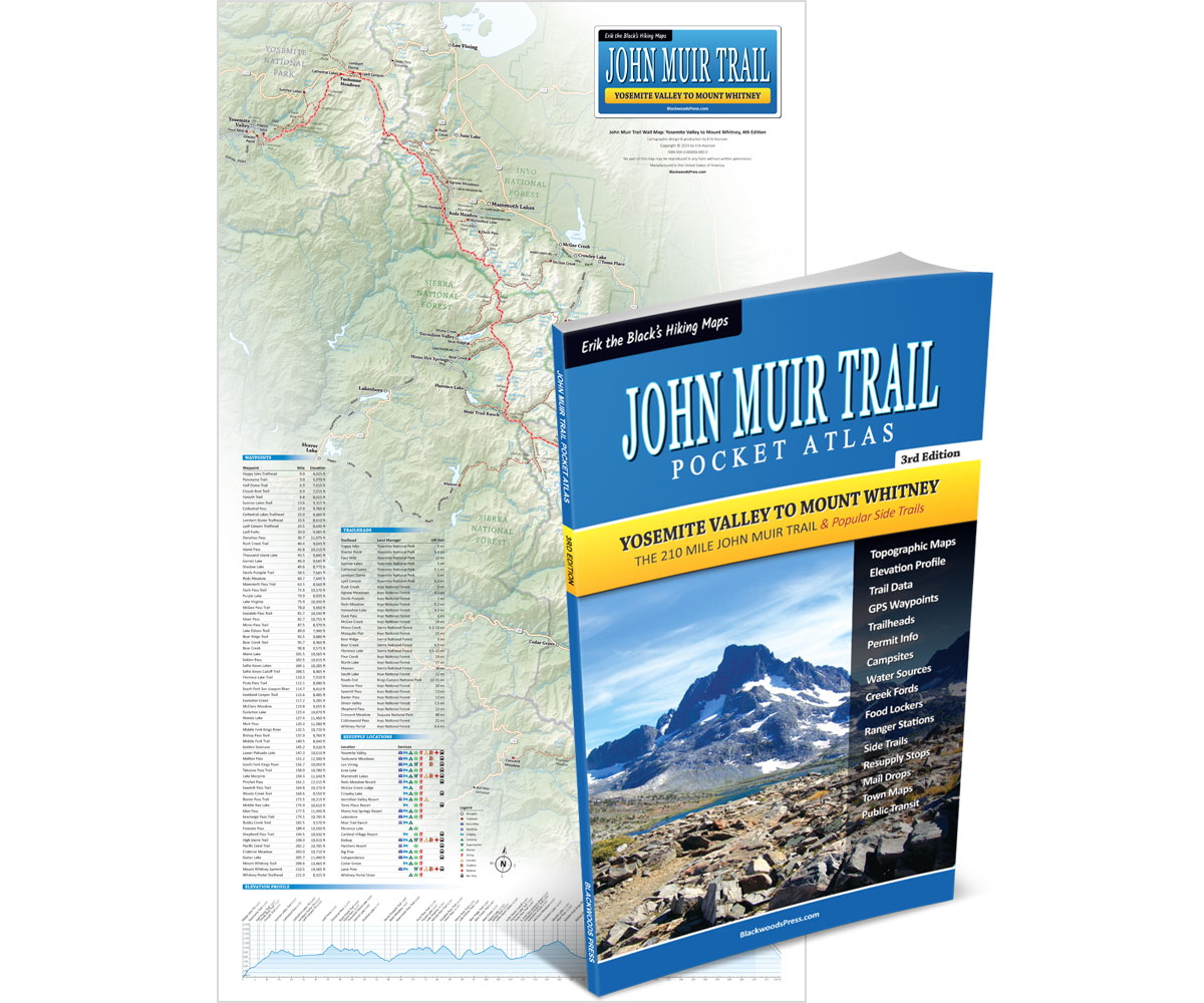

John Muir Trail Map Bundle
Pocket Atlas & Wall Map
By “Erik the Black” Asorson
- John Muir Trail Pocket Atlas, 3rd Edition: All the maps and essential trail data you need to hike the 210 mile John Muir Trail from Yosemite to Mount Whitney (packed into one pocket-size guidebook that weighs just 3 ounces)
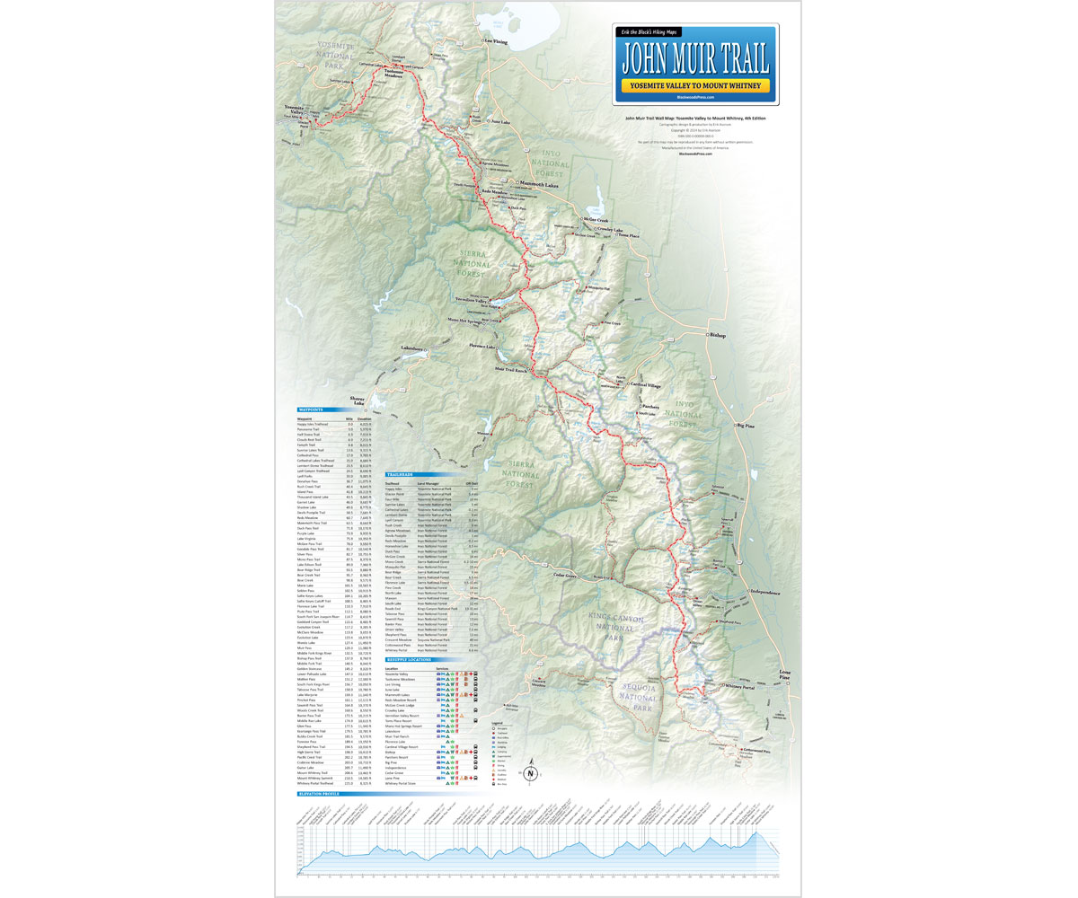
- 14 x 24 inch Laminated Wall Map: Detailed overview of the entire 210 mile John Muir Trail route from Yosemite to Mount Whitney (with mileage, elevation, trailheads, resupply towns and essential trail data)
Product Details
Title: John Muir Trail Map Bundle: Pocket Atlas & Wall Map
Publisher: Blackwoods Press, 3rd edition
Pocket Atlas: 66 pages
Wall Map: 14 x 24 inches (laminated)
Weight: 5.4 ounces
ISBN: 978-1-7367279-6-6
Original price was: $49.95.$39.95Current price is: $39.95.
You Save: $10.00 (20%)

30 day money back satisfaction guarantee
FREE SHIPPING: USPS Ground (3-7 business days)
From the Author: My John Muir Trail Map Bundle includes: John Muir Trail Pocket Atlas (3rd Edition) and John Muir Trail Wall Map (14 x 24 inch, Laminated.) Everything you need to plan your hike and successfully navigate the 210 mile John Muir Trail from Yosemite to Mount Whitney (plus a 20% discount!)

Happy trails,
Author, JMT Thru-hiker
John Muir Trail Maps & The Essential Trail Data You Need To Hike The 210 Mile Trail From Yosemite to Mount Whitney… In One Pocket-Size Book!


John Muir Trail Pocket Atlas
Paperback, 3rd Edition
- Pocket-Size Guidebook: John Muir Trail Pocket Atlas measures 4.5 x 7.5 x 0.2 inches and weighs just 3 ounces
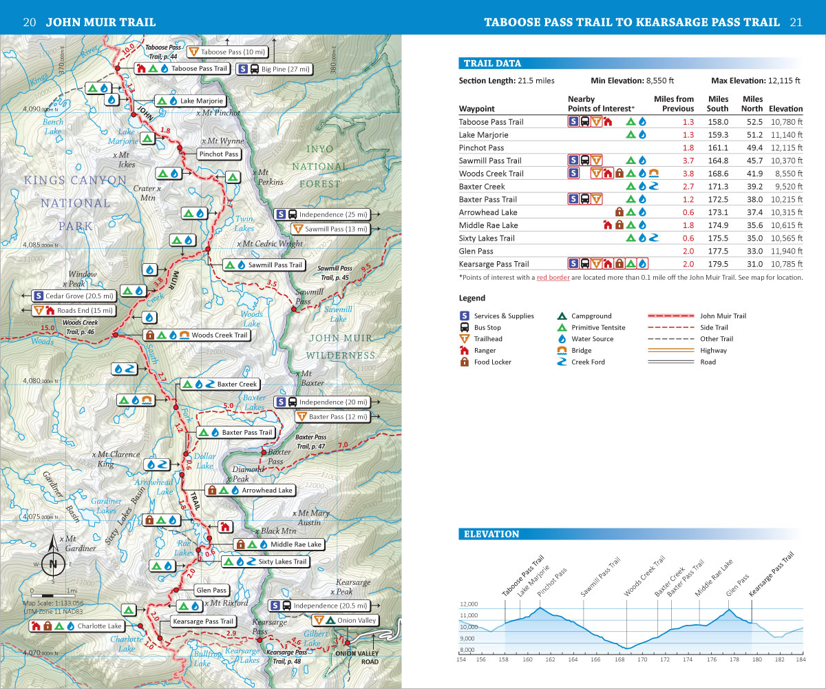
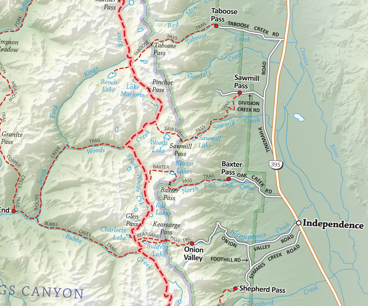
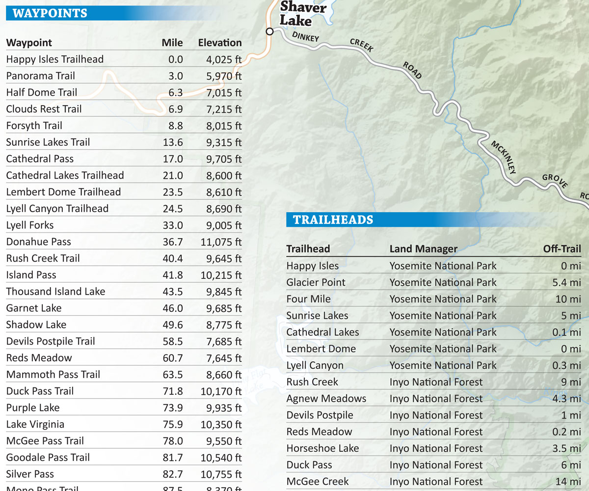
- John Muir Trail Maps: Detailed topographic maps for the entire 210 mile trail (plus 300 miles of side trails)
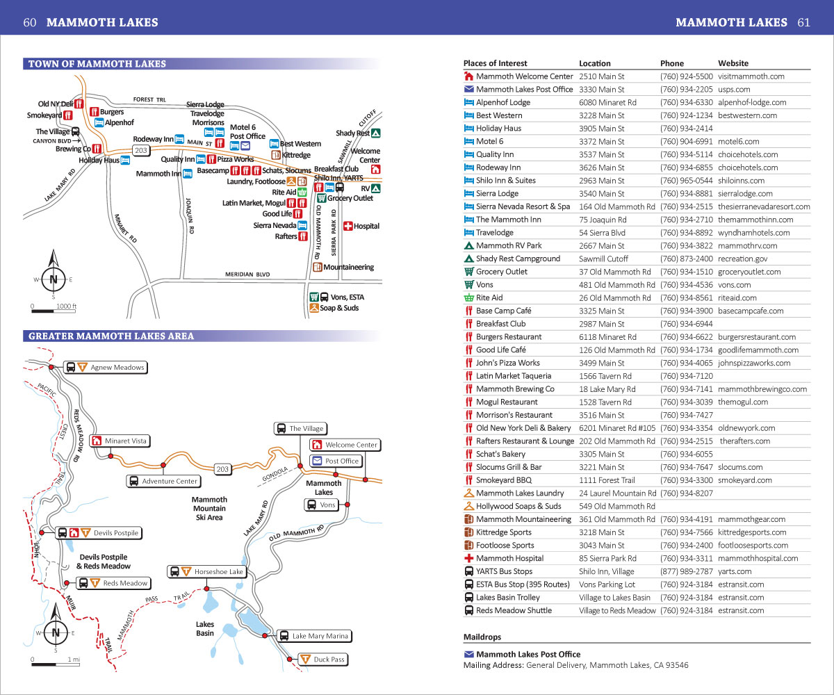
- Points of Interest: Campsites, water sources, trailheads and other important features marked on the maps
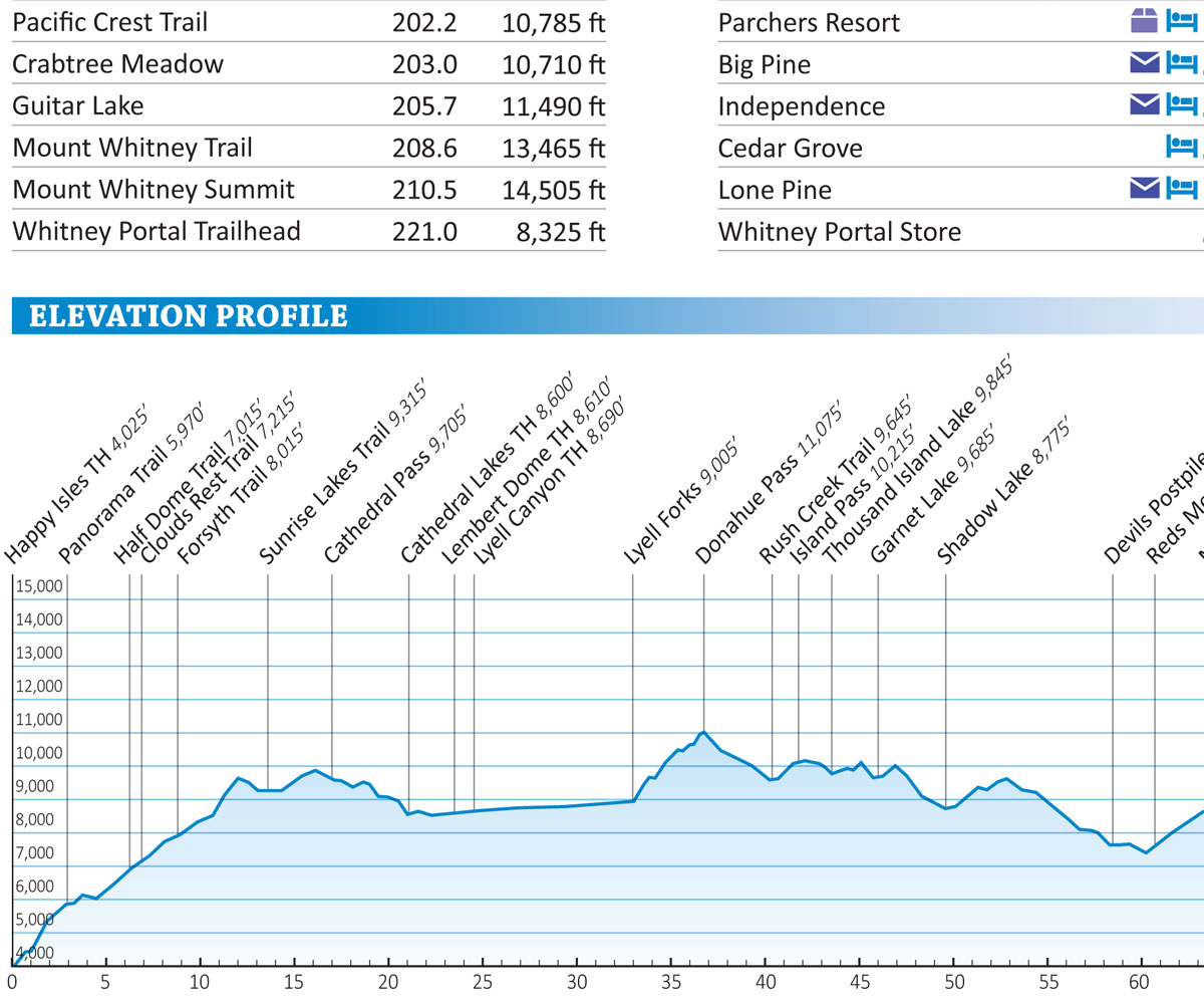
- Mileage and Elevation Data: For important waypoints and points of interest along the John Muir Trail
- Elevation Profiles: See all the peaks, passes and valleys along the route, so you can plan for the big climbs
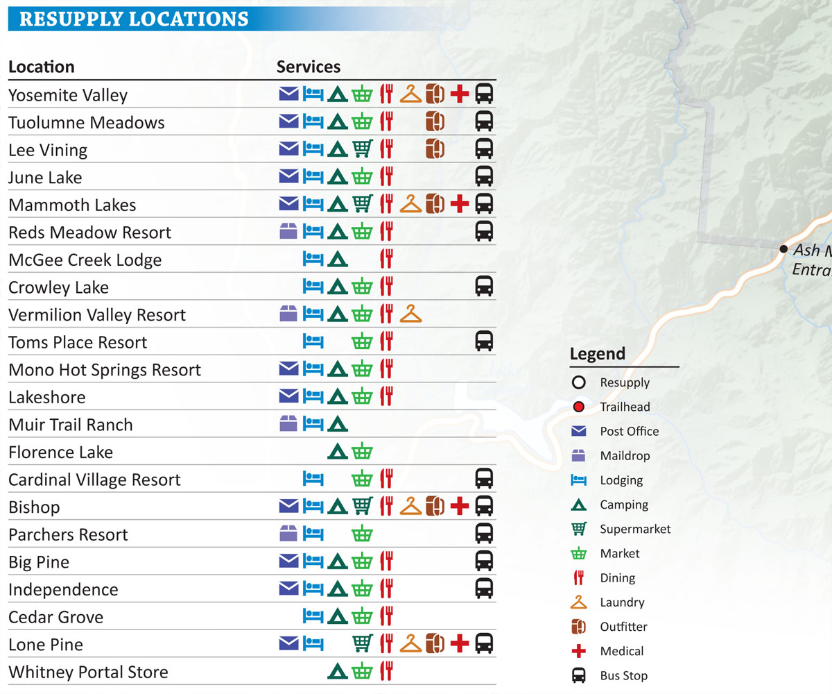
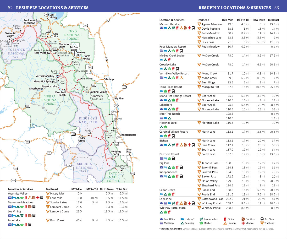
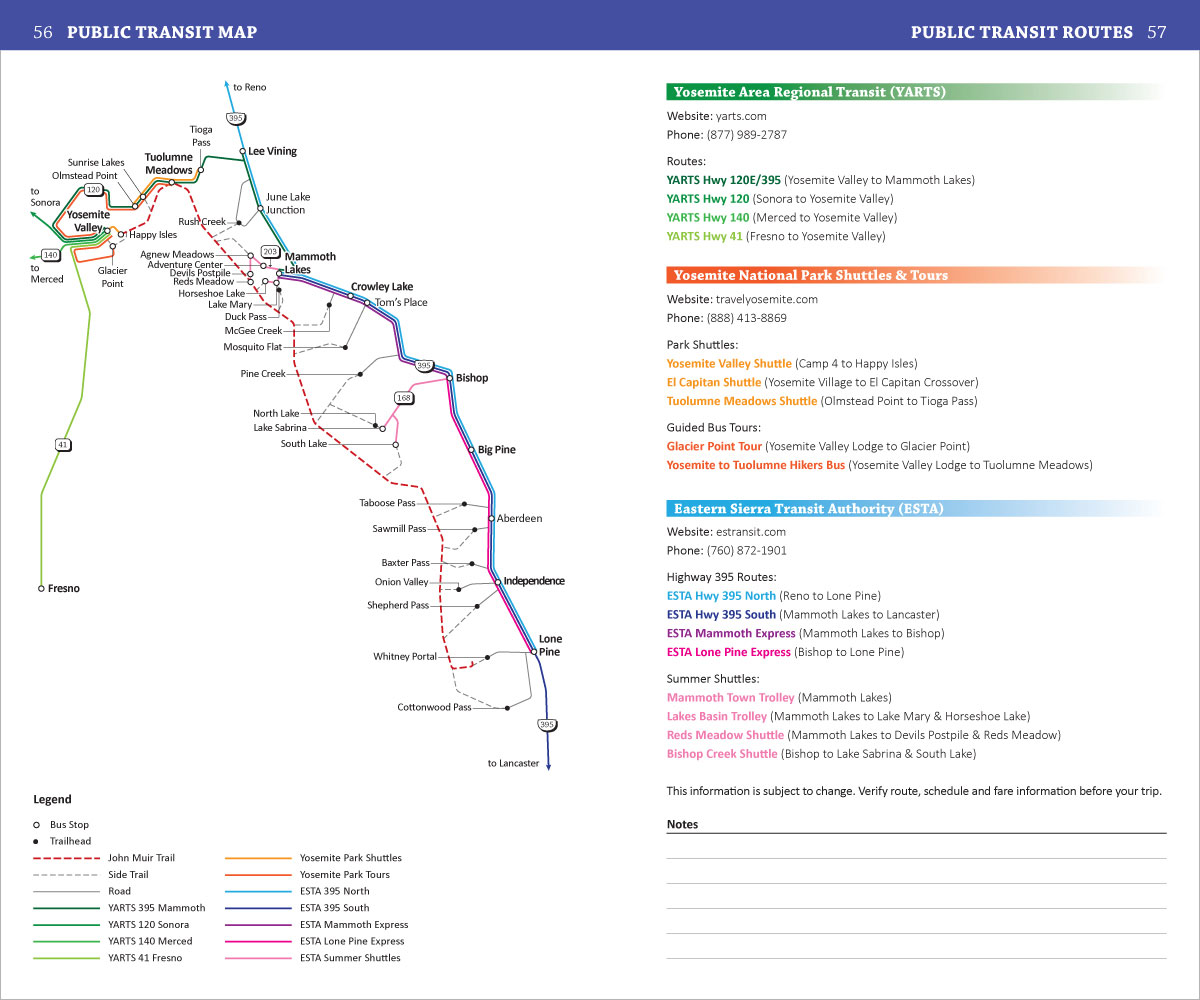
- Resupply Guide: Trail towns, resupply locations, maildrops and hiker services near the John Muir Trail
- GPS Data: Download a GPX file with the waypoints from the book, to use with your Smartphone or GPS
Product Details
Title: John Muir Trail Pocket Atlas
Publisher: Blackwoods Press, 3rd edition
Paperback: 66 pages
Dimensions: 4.5 x 7.5 x 0.2 inches
Weight: 2.7 ounces
ISBN: 978-0-9989228-7-4
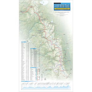
A Detailed Overview Map Of The 210 Mile John Muir Trail From Yosemite to Mt. Whitney (With Essential Trail Data To Help You Plan Your Hike)
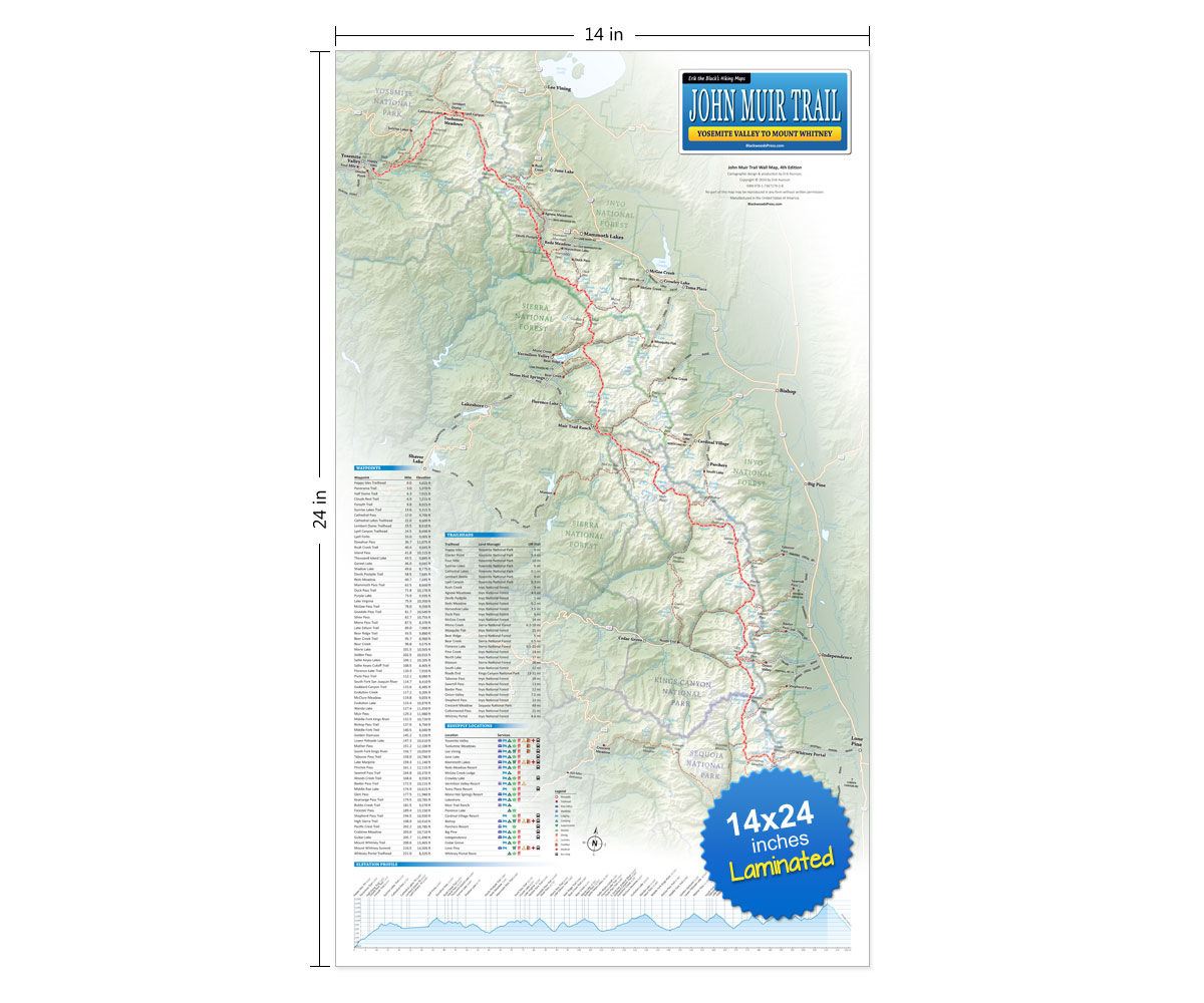
John Muir Trail Wall Map
14 x 24 inch (Laminated)
- 14 x 24 inch Laminated Wall Map: Showing the entire 210 mile John Muir Trail from Yosemite to Mt. Whitney
- Mileage and Elevation Data: For important waypoints and points of interest along the John Muir Trail
- Elevation Profile: See all the peaks, passes and valleys along the route, so you can plan for the big climbs
- Resupply Guide: Trail towns, resupply locations, maildrops and hiker services near the John Muir Trail
Product Details
Title: John Muir Trail Wall Map (Laminated)
Publisher: Blackwoods Press, 4th edition
Dimensions: 14 x 24 inches
Item Weight: 2.7 ounces
ISBN: 978-1-7367279-2-8
Start Planning Your John Muir Trail Adventure!
Order Your John Muir Trail Map & Pocket Atlas Here:

John Muir Trail Map Bundle
Pocket Atlas & Wall Map
Original price was: $49.95.$39.95Current price is: $39.95.
You Save: $10.00 (20%)
30 day money back satisfaction guarantee
FREE SHIPPING: USPS Ground (3-7 business days)