John Muir Trail Maps & Guide Books
By Erik the Black
My John Muir Trail Maps and Guidebooks are designed to give you the essential data you need to plan your hike and navigate the John Muir Trail, in a lightweight and easy to use format:
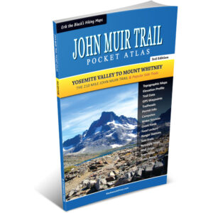
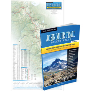
John Muir Trail Pocket Atlas packs all the maps and essential trail data you need to hike the John Muir Trail into one pocket-size booklet that weighs just 3 ounces.
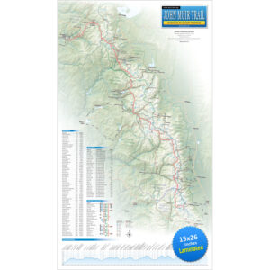
John Muir Trail Wall Map shows the entire 210 mile John Muir Trail route from Yosemite Valley to Mount Whitney, with mileage, elevation profile, resupply locations and essential info to help you plan your hike.

Happy trails,
Author, JMT Thru-Hiker
John Muir Trail Maps & The Essential Trail Data You Need To Hike The 210 Mile Trail From Yosemite to Mount Whitney… In One Pocket-Size Book!

John Muir Trail Pocket Atlas
Paperback, 3rd Edition
- Pocket-Size Guidebook: John Muir Trail Pocket Atlas measures 4.5 x 7.5 x 0.2 inches and weighs just 3 ounces
- John Muir Trail Maps: Detailed maps for the entire 210 mile trail (plus side trails and alternate routes)
- Points of Interest: Campsites, water sources, trailheads and other important features marked on the maps
- Mileage and Elevation Data: For important waypoints and points of interest along the John Muir Trail
- Elevation Profiles: See all the peaks, passes and valleys along the route, so you can plan for the big climbs
- Resupply Guide: Trail towns, resupply locations, maildrops and hiker services near the John Muir Trail
- GPS Data: Download a GPX file containing the waypoints from the book to use with your Smartphone or GPS
- Read more…
John Muir Trail Map Showing The Entire 210 Mile Trail From Yosemite to Mount Whitney… With Essential Information To Help You Plan Your Hike

John Muir Trail Wall Map
14 x 24 inch (Laminated)
- John Muir Trail Map: Showing the entire 210 mile John Muir Trail route from Yosemite to Mount Whitney
- Mileage and Elevation Data: For important waypoints and points of interest along the John Muir Trail
- Elevation Profile: See all the peaks, passes and valleys along the route, so you can plan for the big climbs
- Resupply Guide: Trail towns, resupply locations, maildrops and hiker services near the John Muir Trail
- Read more…