From the Author: My Maps and Pocket Atlases for the Pacific Crest Trail, John Muir Trail, Tahoe Rim Trail, Colorado Trail and Arizona Trail are designed to give you the essential trail data you need to plan your hike and navigate the trails, in a hiker-friendly format. If you like to know where you’re going, but don’t like packing heavy guidebooks and maps, then my minimalist trail guides are for you!

Happy trails,
Founder of Blackwoods Press
Erik the Black’s Pacific Crest Trail Maps and Guide Books, Updated!
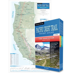
The Pacific Crest Trail travels 2,656 miles from Mexico to Canada across California, Oregon and Washington. My Pocket Atlases and Wall Map include all the essential information you need to plan your hike and successfully navigate the PCT.
-
Sale!
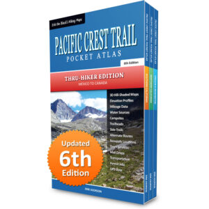
Erik the Black’s Pacific Crest Trail Pocket Atlas: 3-Book Set
Original price was: $89.95.$49.95Current price is: $49.95. -
Sale!
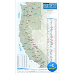
Erik the Black’s Pacific Crest Trail Wall Map (Laminated)
Original price was: $29.95.$24.95Current price is: $24.95. -
Sale!
Erik the Black’s Pacific Crest Trail Map Bundle
Original price was: $99.95.$64.95Current price is: $64.95. -
Sale!

Erik the Black’s Pacific Crest Trail Pocket Atlas: Southern California
Original price was: $29.95.$24.95Current price is: $24.95. -
Sale!

Erik the Black’s Pacific Crest Trail Pocket Atlas: Northern California
Original price was: $29.95.$24.95Current price is: $24.95. -
Sale!

Erik the Black’s Pacific Crest Trail Pocket Atlas: Oregon & Washington
Original price was: $29.95.$24.95Current price is: $24.95.
Erik the Black’s John Muir Trail Maps and Guide Books
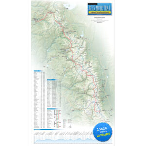
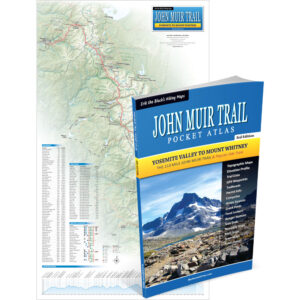
The John Muir Trail travels 210 miles from Yosemite Valley to Mount Whitney across the High Sierras of central California. My Pocket Atlas and Wall Map include all the essential information you need to plan your hike and successfully navigate the JMT.

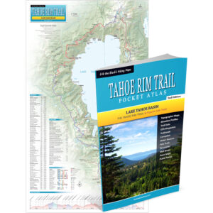
Erik the Black’s Tahoe Rim Trail Maps and Guide Books
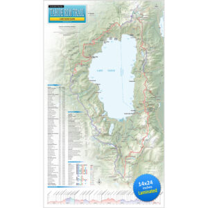
The Tahoe Rim Trail is multi-use trail for hikers, bikers and equestrians that forms a 171 mile loop around around Lake Tahoe. My Pocket Atlas and Wall Map include all the essential information you need to plan your hike and successfully navigate the TRT.

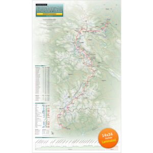
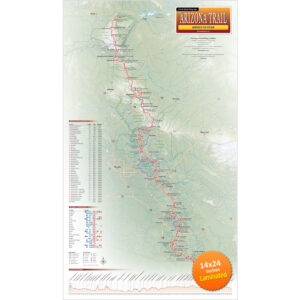
Erik the Black’s Colorado Trail Maps and Arizona Trail Maps
The Colorado Trail travels 570 miles from Denver to Durango. The Arizona Trail travels 800 miles from Mexico to Utah. Both trails are open to hikers, bikers and equestrians. My laminated wall maps show the entire trail with essential data to help plan your trip.