Colorado Trail Weather Data
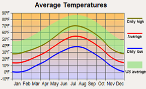
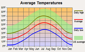
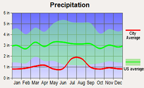
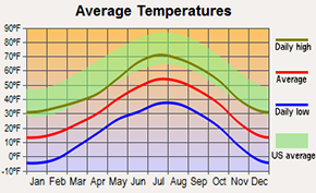
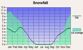
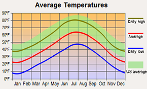
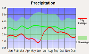
The regular hiking season for the Colorado Trail is late-Spring to early-Fall, when the route is mostly free of snow and temperatures are above freezing. Here is a collection of current and average weather data from the towns closest to the Colorado Trail. This should give you a general idea of what kind of conditions to expect at different times of year. The elevation of the Colorado Trail itself is usually higher than the towns, so keep in mind that temperatures may be slightly cooler than what is shown here.
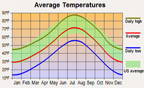

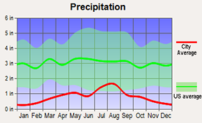
Current weather data from AccuWeather.com. Average weather data from City-Data.com

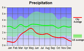
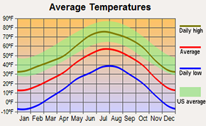
Current weather data from AccuWeather.com. Average weather data from City-Data.com
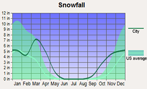
Current weather data from AccuWeather.com. Average weather data from City-Data.com
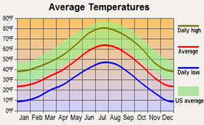

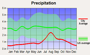
Current weather data from AccuWeather.com. Average weather data from City-Data.com
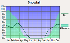
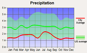
Current weather data from AccuWeather.com. Average weather data from City-Data.com

Current weather data from AccuWeather.com. Average weather data from City-Data.com

Current weather data from AccuWeather.com. Average weather data from City-Data.com