Colorado Trail Town Guide

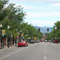
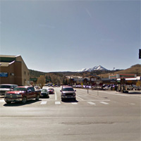
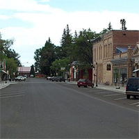
Denver
Population: 600,000
Elevation: 5,280 ft
Zip Code: 80202 (Downtown)
Distance From Trail: ~20 miles from Waterton Canyon Trailhead (mile 0.0)
Hiker Services: Post Office, Lodging, Supermarket, Restaurant, Outfitter
Public Transportation: Denver RTD, Greyhound, Amtrak, DEN Airport,
Places of Interest: Union Station, REI Flagship Store, 11th Ave Hotel & Hostel
Littleton
Population: 41,730
Elevation: 5,351 ft
Zip Code: 80120
Distance From Trail: ~10 miles from Waterton Canyon Trailhead (mile 0.0)
Hiker Services: Post Office, Lodging, Supermarket, Restaurant, Outfitter
Public Transportation: Denver RTD
Places of Interest: Mineral Station, Chatfield State Park, Roxborough State Park
Conifer
Population: 19,700
Elevation: 8,277 ft
Zip Code: 80433
Distance From Trail: 17 miles from South Platte Canyon Trailhead (mile 16.5)
Hiker Services: Post Office, Lodging, Supermarket, Restaurant
Public Transportation: Denver RTD
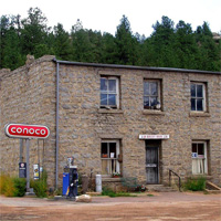
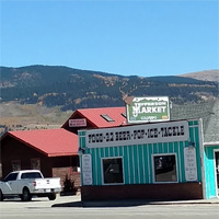
Buffalo Creek
Population: n/a
Elevation: 6,762 ft
Zip Code: 80425
Distance From Trail: 4.5 miles from Little Scraggy Trailhead (mile 27.9)
Hiker Services: Post Office, Market
Places of Interest: J W Green Mercantile Co (Post Office)
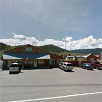
Bailey
Population: n/a
Elevation: 7,739 ft
Zip Code: 80421
Distance From Trail: 8 miles from Rolling Creek Trailhead (mile 40.1)
Hiker Services: Post Office, Lodging, Market, Restaurant
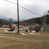
Jefferson
Population: n/a
Elevation: 9,501 ft
Zip Code: 80456
Distance From Trail: 4.3 miles from Kenosha Pass Trailhead (mile 71.6)
Hiker Services: Post Office, Maildrop, Market, Restaurant
Places of Interest: Pony Espresso (Post Office), Jefferson Market (Maildrop)
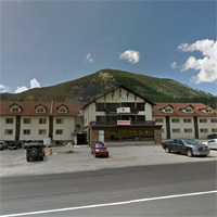
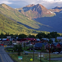
Fairplay
Population: 679
Elevation: 9,953 ft
Zip Code: 80440
Distance From Trail: 20.5 miles from Kenosha Pass Trailhead (mile 71.6)
Hiker Services: Post Office, Lodging, Supermarket, Restaurant
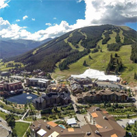
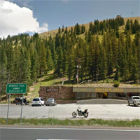
Breckenridge
Population: 4,540
Elevation: 9,600 ft
Zip Code: 80424
Distance From Trail: 4 miles from Goldhill Trailhead (mile 104.4)
Hiker Services: Post Office, Maildrop, Lodging, Supermarket, Restaurant, Outfitter
Public Transportation: Summit Stage
Places of Interest: Fireside Inn (Maildrop), The Bivvi Hostel (Maildrop)
Frisco
Population: 2,683
Elevation: 9,075 ft
Zip Code: 80443
Distance From Trail: 5.2 miles from Goldhill Trailhead (mile 104.4)
Hiker Services: Post Office, Lodging, Supermarket, Restaurant, Outfitter
Public Transportation: Summit Stage
Silverthorne
Population: 3,887
Elevation: 9,035 ft
Zip Code: 80497
Distance From Trail: 10 miles from Goldhill Trailhead (mile 104.4)
Hiker Services: Post Office, Lodging, Supermarket, Restaurant, Outfitter
Public Transportation: Summit Stage
Copper Mountain Resort
Population: n/a
Elevation: 9,712 ft
Distance From Trail:
1 mile from Copper Mountain Trailhead (mile 116.8)
0.2 mile from Wheeler Gulch junction (mile 119.0)
Hiker Services: Lodging, Market, Restaurant
Public Transportation: Summit Stage
Leadville
Population: 2,602
Elevation: 10,152 ft
Zip Code: 80461
Distance From Trail:
10 miles from Tennessee Pass Trailhead (mile 142.6)
9.8 miles from Timberline Lake Trailhead (mile 156.0)
11.5 miles from Mount Massive Trailhead (mile 169.0)
Hiker Services: Post Office, Maildrop, Lodging, Supermarket, Restaurant, Outfitter
Public Transportation: Summit Stage
Places of Interest: Leadville Hostel (Maildrop)
The next ten locations are accessible from The Colorado Trail and/or Collegiate West Alternate. CT = Colorado Trail, CW = Collegiate West.
Twin Lakes
Population: 171
Elevation: 9,200 ft
Zip Code: 81251
Distance From Trail:
1.3 miles from Highway 82 crossing (CT mile 176.6)
6.3 miles from Interlaken Trailhead (CT mile 181.2, CW mile 0.0)
2 miles from Willis Gulch Trailhead (CW mile 4.2)
Hiker Services: Mail Drop, Lodging, Market, Restaurant
Places of Interest: Twin Lakes General Store (Maildrop)
Buena Vista
Population: 2,617
Elevation: 7,965 ft
Zip Code: 81211
Distance From Trail:
7 miles from Silver Creek Trailhead (CT mile 209.1)
8.8 miles from Avalanche Trailhead (CW mile 216.1)
19.2 miles from Cottonwood Pass Trailhead (CW mile 35.7)
Hiker Services: Post Office, Lodging, Supermarket, Restaurant, Outfitter
Public Transportation: Chaffee Shuttle
Taylor Park
Population: n/a
Elevation: 9,408 ft
Distance From Trail: 15.8 miles from Cottonwood Pass Trailhead (CW mile 35.7)
Hiker Services: Maildrop, Lodging, Market, Restaurant
Places of Interest: Taylor Park Trading Post (Maildrop)
Mount Princeton Hot Springs
Population: n/a
Elevation: 8,162 ft
Distance From Trail:
On-trail (CT mile 229.4)
15.3 miles from Tincup Pass Trailhead (CW mile 51.5)
Hiker Services: Maildrop, Lodging, Market, Restaurant
Places of Interest: Mount Princeton Hot Springs Resort (Maildrop)
Poncha Springs
Population: 737
Elevation: 7,464 ft
Zip Code: 81242
Distance From Trail:
9.6 miles from Hwy 50 Trailhead (CT mile 252.3)
14 miles from Boss Lake Trailhead (CW mile 67.4)
18 miles from Monarch Pass Trailhead (CW mile 78.2)
Hiker Services: Post Office, Lodging, Market, Restaurant
Public Transportation: Chaffee Shuttle

Salida
Population: 5,236
Elevation: 7,083 ft
Zip Code: 81201
Distance From Trail:
14.5 miles from Hwy 50 Trailhead (CT mile 252.3)
19 miles from Boss Lake Trailhead (CW mile 67.4)
23 miles from Monarch Pass Trailhead (CW mile 78.2)
Hiker Services: Post Office, Maildrop, Lodging, Supermarket, Restaurant, Outfitter
Public Transportation: Chaffee Shuttle
Places of Interest: Simple Lodge & Hostel (Maildrop)
Monarch (aka Garfield)
Population: n/a
Elevation: 9,620 ft
Distance From Trail:
3 miles from Hwy 50 Trailhead (CT mile 252.3)
1.5 miles from Boss Lake Trailhead (CW mile 67.4)
5.5 miles from Monarch Pass Trailhead (CW mile 78.2)
Hiker Services: Maildrop, Lodging, Restaurant
Places of Interest: Monarch Mountain Lodge (Maildrop)
Monarch Pass
Population: n/a
Elevation: 11,312 ft
Distance From Trail: On-Trail (CW mile 78.2)
Hiker Services: Maildrop, Market
Places of Interest: Monarch Crest Gift Shop (Maildrop)
Sargents
Population: n/a
Elevation: 8,478 ft
Distance From Trail:
10 miles from Monarch Pass Trailhead (CW mile 78.2)
17 miles from Marshall Pass Trailhead (CT mile 266.3)
Hiker Services: Maildrop, Lodging, Market, Restaurant
Places of Interest: Tomichi Creek Trading Post (Maildrop)
Gunnison
Population: 5,854
Elevation: 7,703 ft
Zip Code: 81230
Distance From Trail:
42 miles from Monarch Pass Trailhead (CW mile 78.2)
38 miles from Hwy 114 Trailhead (CT mile 302.1)
Hiker Services: Post Office, Maildrop, Lodging, Supermarket, Restaurant, Outfitter
Public Transportation: Gunnison Valley RTA, Chaffee Shuttle
Places of Interest: Wanderlust Hostel (Maildrop)
Saguache
Population: 493
Elevation: 7,707 ft
Zip Code: 81149
Distance From Trail: 32 miles from Hwy 114 Trailhead (mile 302.1)
Hiker Services: Post Office, Lodging, Market, Restaurant
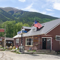
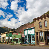
Creede
Population: 290
Elevation: 8,799 ft
Zip Code: 81130
Distance From Trail:
7.5 miles from San Luis Pass Trailhead (mile 342.1)
33 miles from Spring Creek Pass Trailhead (mile 356.9)
Hiker Services: Post Office, Lodging, Supermarket, Restaurant, Outfitter
Lake City
Population: 408
Elevation: 8,661 ft
Zip Code: 81235
Distance From Trail: 17 miles from Spring Creek Pass Trailhead (mile 356.9)
Hiker Services: Post Office, Maildrop, Lodging, Supermarket, Restaurant, Outfitter
Places of Interest: The Raven’s Rest Hostel (Maildrop)
Molas Lake
Population: n/a
Elevation: 10,520 ft
Distance From Trail: 1.5 miles from Molas Pass Trailhead (mile 410.2)
Hiker Services: Maildrop
Places of Interest: Molas Lake Campground (Maildrop)
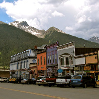
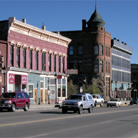
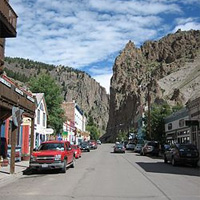
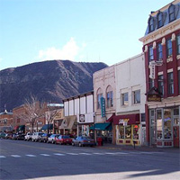
Silverton
Population: 638
Elevation: 9,308 ft
Zip Code: 81433
Distance From Trail: 6.3 miles from Molas Pass Trailhead (mile 410.2)
Hiker Services: Post Office, Maildrop, Lodging, Supermarket, Restaurant, Outfitter
Places of Interest: Blair Street Hostel (Maildrop), Prospector Motel (Maildrop), Durango & Silverton Railroad
Durango
Population: 17,557
Elevation: 6,512 ft
Zip Code: 81301
Distance From Trail: 3.5 miles from Junction Creek Trailhead (mile 484.4)
Hiker Services: Post Office, Lodging, Supermarket, Restaurant, Outfitter
Public Transportation: Durango Transit, Greyhound, Durango-La Plata Airport
Places of Interest: Durango & Silverton Railroad
Sending maildrops to a US Post Office: Post Offices will accept general delivery packages and hold them for up to 30 days. You will need to show ID to pick up your package. Some small town post offices keep reduced hours, so check the USPS website to see when they will be open.
Address general delivery packages like this: Your Name, c/o General Delivery, Town, ZIP, Estimated Pickup Date: _____
Sending maildrops to a private business. Many of the businesses catering to hikers will accept maildrops too. If you check their website, they sometimes have shipping instructions and their preferred carrier (USPS, UPS, Fedex) listed. If not, contact them directly for instructions.