Colorado Trail Planning Guide
Thanks for purchasing a Colorado Trail Pocket Atlas!
Here are some additional resources and information to help you plan your Colorado Trail adventure.
Happy trails,

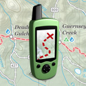
Colorado Trail GPS Waypoints
All of the waypoints from your Colorado Trail Pocket Atlas. Upload this GPX file to your GPS receiver and you will be able to quickly navigate to the locations in the book.

Colorado Trail Gear Lists
Wondering what to pack on the Colorado Trail? Here are three example gear lists showing everything you’ll need for multi-day hikes or thru-hiking in the Rocky Mountains between Denver and Durango.

Colorado Trail Town Guide
A detailed list of hiker-friendly towns and outposts near the Colorado Trail (and Collegiate West) where you can rest, resupply or send a maildrop.
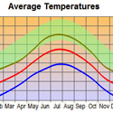
Colorado Trail Weather Data
A collection of current and average weather data from towns near the Colorado Trail. This will give you a general idea of what kind of conditions to expect at different times of year.
Colorado Trail Thru-Hiking Itineraries
How long does it take to thru-hike the Colorado Trail? Here are three example itineraries showing how you can hike the entire trail from Denver to Durango in four, five or six weeks.

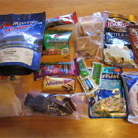
Top 10 Ultralight Backpacking Foods
Ten of my favorite high-calorie hiking foods. These provide, on average, more than 100 calories per ounce, making them ideal for lightweight backpacking.
Five Day Lightweight Backpacking Meal Plan
A complete 5-day meal plan similar to what I eat on my long-distance backpacking trips. This plan provides 3,500 – 5,000 calories a day from 2-3 pounds of food.
PMags End to End Guide
Planning a thru-hike? Check out Paul Magnanti’s website. He provides a lot of useful information and advice for aspiring Colorado Trail thru-hikers.
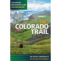
The Official Colorado Trail Guidebook
Due to it’s size and weight, you probably don’t want to pack the official guidebook with you on the trail, but it is an excellent resource to keep at home for trail research and trip planning before you go.
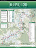
Colorado Trail Wall Map
18 x 24″ laminated wall map shows the entire route of the Colorado Trail and other points of interest (access roads, trailheads, elevation profiles and resupply stops), designed to make planning your hikes quick and easy.

The Colorado Trail Foundation
The Colorado Trail Foundation is the organization that takes care of the Colorado Trail. Visit their website to find the latest news and updates and to support the trail.