Tahoe Rim Trail Pictures

The Tahoe Rim Trail is a long-distance backpacking and hiking trail that forms a 170 mile loop around Lake Tahoe in the Sierra Nevada and Carson mountain ranges of California and Nevada. I thru-hiked the Tahoe Rim Trail in the fall of 2011.
Here are some pictures from my trip…


Have any questions about the Tahoe Rim Trail? Post your comments below…
 My name is Erik Asorson, aka "Erik the Black." I'm a long-distance backpacker, cartographer and author of
Eric,
Could you please post a copy of your itinerary and did you fly into Reno airport?
@Tre: I started at Kingsbury Grade and hiked clockwise, resupplying in Echo Lake and Tahoe City, and took about 10 days to complete the trail. I live in California so I drove up there, but Reno is the closest airport. I am going to be thru-hiking the TRT again soon and I think next time I will start a Tahoe Meadows instead.
Hi Erik, going to do 3 days on the TRT but need recommendations for what section to do. We are a group of 4 who don’t hike unless we’ve a trip coming up (usually 2 trips year). We are runners so relatively fit. Looking for moderate hiking. Going end of Sept. Thanks for your time 🙂
@TC: You really can’t go wrong with any section of the TRT. They are all easily accessible from town with trailheads at both ends. The difficulty is pretty moderate/easy, so if you are in decent shape you’ll have no problems. My personal favorite section of the trail is the northeast portion, because it’s really pretty and provides lots of peekaboo views of the lake.
Eric. Planning on doing the TRT this August. Used your atlas for the JMT last year and it was invaluable. Looking forward to the TRT. Do you still like the idea of starting at Tahoe Meadows? Where would you camp that first night? Thanks again for such great information!
I am hiking TRT this summer with my brother and sister in law. They only have off mid July – beginning of August. I have read conflicting accounts about hiking in July. I hear the wild flowers are amazing though bugs can be bad. What is everyone’s experience with doing it in July?!
@Amanda Rich: The bugs are bad in the Desolation Wilderness, but they are not too terrible on the rest of the trail. If you pack a headnet and bug repellant you should be OK.
Erik, great site and extremely helpful. I saw in one of your posts that you didn’t use a bear canister on your TRT hike. Did you tie your food up into a tree? Also, what is the reasoning for leaving your bear canister out in the open in a flat area? I saw that mentioned on another site talking about bear cansiters. Thanks.
@Kyle: I did not hang food on the TRT, although you could if you wanted to. There are black bears in the area and I’m sure they can be trouble sometimes, but they are not known for being as audacious as the habituated “park bears” in Yosemite and the Sierras and places like that. In places where black bears live but don’t usually cause problems I don’t do anything special with my food. I just risk it. It’s a good idea to leave your bear canister away from your campsite because it may still attract bears, and a flat area is good because a bear might still bat it around a bit trying to get inside. If it’s on a slope he might knock it down a hill and you could have a hard time finding it in the morning. Sometimes I like to stuff my bear canister into a crevasse in some rocks or pile rocks up around it just to make it harder for a bear to get to.
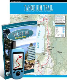
Erik, many thanks for your work on the pocket atlas. I complete my TRT thru hike last week and it was invaluable. I like electronic devices with maps for the convenience, but I always carry a map and compass. And as I’m so fond of telling my backpacking club, “an electronic device will always fail you at the moment you need it the most”. Which it did, but I never faltered, knowing I had a trustworthy paper guidebook in my packs shovel pocket to use. I also referred to it heavily when trip planning and creating my itinerary. Again excellent job and thanks!
Kung Fu Panda
@Panda: Thanks for the kinds words and congratulations on completing your TRT thru-hike. Glad to hear the atlas was useful along the way 🙂
Hi Erik. Thanks for the info. I’m going to thru hike the TRT soon. I’m looking at permits for desolation wilderness… you have to reserve a specific spot and date and then pay $16; I’d rather avoid that by hiking through the Desolation Wilderness section of TRT without overnighting and having to pay. How many miles do you think it is (I guestimate 12?), and is it possible to go through in a day? Say, Echo Lake to Sourdough Hill?
So I had estimated the desolation wilderness section of the TRT at 12 miles with a bad online map. I just got a real map delivered, and it looks more like 22 miles.
@Alex Dash: You could certainly hike through the Desolation Wilderness without camping if you don’t mind a long day. It’s really beautiful, but it’s also really mosquitoey, so not camping there has it’s benefits 😉
Do you carry a solar panel to charge up your stuff. If so what kind?
Rodger
@Rodger Wilson: I recently bought a Creative Edge Solar Charger & Battery Pack, but I haven’t had an opportunity to really test it out yet.
Rodger,
I use a solar charger from Suntactis. The S charger 5 It has been with me on 3 JMT hikes and the TRT.
It is simple, light and sturdy. Made in the USA too.
Hi Erik. My daughter and I do adventure hiking every year…last year we did the West Coast Trail…this year we are thinking about TRT but I only have about 8 days…you think we can circle in 8?
@J Bushnell: If you are in shape 8 days should be no problem for the TRT. It is a pretty easy trail (not a lot of steep climbing). You would need to do 20-25 miles a day, depending on whether you take a day off in the middle.
Hello again, 2 questions. If I’m flying in to Reno then taking a shuttle & starting at Kingsbury Grade South – where can I buy gas for my stove? Suggestions? Also, we’ll be taking a zero day for resupply in Tahoe City and really like your idea of doing a float down the Truckee River, can you just show up to rent a raft with no reservation? Just wondering. I may have more questions about the shuttle situation to/from Kingsbury TH as it looks like I may have to take a taxi the last bit – I have to research that a little more. THANK YOU!
@Beth: There are outfitters where you can buy stove fuel and other backpacking stuff in Tahoe City and South Lake Tahoe. There might be fuel at the small store at Echo Lake too, but I can’t remember for certain.
Floating the Truckee does not require a reservation. There is a gas station and grocery store right near the put in that sell inexpensive personal sized tubes and rafts. There are also guided tours on larger rafts going down the river which might require a reservation.
Did you have trouble finding water on the TRT? Also how many miles did you average per day? Was there plenty of places to camp?
@Glen: There is more water available on the west side than the east side, but it wasn’t a problem in general. You can see the locations of water sources in my Tahoe Rim Trail Atlas. I hiked about 15 miles a day and there are lots of good campsites. The TRT is well-maintained, easy to hike and in a beautiful location. It’s a great option for a shorter thru-hike that fits into a two-week vacation.
hi Eric.You do a nice job on you trail atlas Do you know of any ultralight white gas stoves ? I like white gas stoves cuz I can see how much fuel i have at all times.I am an ultra light guy like you
Hi Erik, My husband & I are looking at doing TRT next year. Bought your pocket book actually! We’ve done JMT & plenty of long backpacks in CO so we know how to pack lightweight, etc. I’m wondering, is there a reason most people go clockwise? We are contempating going end of June/beginning of July when there may be more water available on the eastern side. We are considering going counter clockwise to get the eastern portion over before the July 4th busy holiday. It seems the eastern side gets busier with the mountain bikers. Plus we thought it would be more enjoyable going opposite the PCTers. Your thoughts on time of year & going counter clockwise? What about the skeeters that time of year? We’ve only been to the Sierras in late Sept/early Oct. Thanks for your help!!
@Beth: My guess for why most people go clockwise is that’s the way the sections are laid out on the TRT website and possibly because of water concerns on the east side. But, as long as you have a strategy for water and resupply you can start wherever you like and go either direction. The only part of the TRT that I found the mosquitoes to be really bad was in Desolation Wilderness on the southwest side – they are gnarly there. But, the rest of the trail was pretty mild in the skeeter dept – nowhere near as bad as the JMT.
HI Erik…I’ll be headed to Lake Tahoe in early June to do some hiking. In your opinion…if I had only one day to spend of the Rim Trail….which section should I hike? Thanks!
@Linda Gray: If I only had one day I’d hike Section 3 from Mt Rose to Spooner Summit. It’s an easy hike with great views of the lake.
Thanks so much, Erik! With so many hiking choices in the Tahoe area….choosing which ones to do can be a little overwhelming!! We will be there next weekend!
Planning a thru hike of the TRT this summer and just ordered your Pocket Guide. I have a couple of questions about the TRT:
1. I would really like to use my hammock. Is it possible to hammock the whole trail?
2. Thinking of going in mid July, but heard tales of really bad bug issues. Is this a bad time for bugs on the TRT? Should I wait until later on in the summer?
Really enjoy your website!!
Thanks,
Mike
@Mike: I think you should be able to get away with hammocking on the TRT. There are trees near most of the trail. There are some places where they are a bit sparse so you may have to look around a bit for a good spot.
I would not let the mosquitoes deter you from hiking in the summer. Mosquitoes are a fact of life in the Sierra, but they are not as bad around Lake Tahoe as in some other places. The worst spot on the TRT for Mosquitoes is probably the Desolation Wilderness area since there are lots of lakes.
As long as you have a shelter with full bug netting, bug repellant, headnet, a long sleeve shirt (a nylon wind shirt or lightweight rain jacket works good for keeping the bugs off your arms) and pants you should be fine. They are the most active in the morning and evening. I think you will find that in many places there are no mosquitoes at all during the day.
Also, we had an abnormally dry winter in California this year, so less snow melt may mean fewer mosquitoes this summer (fingers crossed).
I hiked the TRT last year with my Hennessey Hammock and never had a problem finding a place to hang it. In fact, my friend was jealous of me as he always had trouble finding a level spot on the ground while my hammock was always comfortable.
Erik,
Does the TRT tend to be more crowded during the mid-summer (i.e. July-August) than it would be post-Labor Day? My version of “overcrowded” is the AT in Georgia in early April. I just don’t want to be competing every night for the best camping spots. I am debating on whether to go in mid-July or just after Labor Day.
@David: I can’t say for certain, but I do not believe the TRT ever gets as crowded as the AT, except maybe on holidays. I have hiked there in the mid summer and early fall and it was not crowded at all.
I hiked the TRT in July last year and didn’t see many people at all. In fact, my friend and I had the entire campground (the name escapes me right now but it’s one of the 2 that’s required on the east side) to ourselves. There were some mountain bikers and a few day hikers near the trailheads but finding a good campsite was never an issue for us.
Hi Erik,
I just finished a thru hike on the TRT and I carried your new TRT Pocket Atlas.
I found your info to be very helpful in my planning and while on the trail.
Thank you.
I highly recommend your guides to anyone who is thinking about backpacking on the TRT.
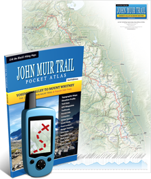
Fyi: The binding on my atlas did not hold up. It broke down after about 6 days. I bought your JMT Pocket Atlas in 2011 and used it on two long section hikes and the atlas held together.
Erik, Just finished my thru hike of the TRT using your atlas. It was a wonderful trip and your atlas was great. The water sources and camp sites really helped. The equipment and food lists and your recommendations also helped me keep my pack weight down. Thanks for providing a great site with so much useful information. I plan on doing the JMT next year and will be using your atlas for that hike also. Thanks again for a great resource. Happy Trails.
@Erik: Here’s our basic itinerary, what do you think?
Tahoe Meadows TH to Marlette Peak Campground 13.00:13.00
Marlette Peak Campground to Genoa Peak Rd. (Pond) 12.3:25.3
Genoa Peak Rd. to Kingsbury Junction S. 14.5:39.8
Kingsbury Junction S. to Armstrong Pass 13.00:52.8
Armstrong Pass to Big Meadow TH 9.7:62.5
My Son and I are getting ready to do a few sections of the TRT in a week or so .. my question, for anyone familiar with trail, if we start at Mt. Rose Summit TH where should we plan to sleep the first night .. if i read my trail guide correctly, we would have to hike around 15 miles the first day to hit Marlette Peak Campground .. I worry 15 mi. might be a bit far for our first day out ..
Any thoughts? Advice? Thx!
@Nathan: The camping restriction in this section begins when you enter Lake Tahoe Nevada State Park which is about 8 miles from Mount Rose Summit TH. Camping is still allowed before that. I don’t remember seeing many well used camp spots in this area, but you can probably find a place to pitch a tent in a pinch. Once you enter the State Park, Marlette Peak Campground is the first place where camping is allowed. It is a very nice campground with several sites, picnic tables, toilets and a well for water. The entire section from Mt Rose to Spooner Summit is one of the easiest (and most scenic) sections of the trail, so I think you may reach the campground quicker than you anticipate. The trail is very well graded with only moderate climbs and descents, and this section has some of the best views of Lake Tahoe on the entire trip.
Good deal, Nathan! I’m heading up there on the 9th for a thru hike and starting at the same spot. I wanted to get the heavy portions done early since you have to schlep so much water through those areas right now.
Update: My Tahoe Rim Trail Pocket Atlas and Tahoe Rim Trail Wall Map are both in stock now and available to purchase from our online store.
Thanks for doing these Erik. I’m taking mine on the trip (the one recommended by TRTA is a brick! 12oz!) next week. One thing for ver. 2.0, the side charts with elevations cite “diff” but i think you meant “dist” of that passage. It’s a great resource.
I just preordered your TRT trailguide.
I hope the delivery window is solid as I’m leaving to hit it on August 2nd!
Thanks for the photos!
I’m planning to start the TRT at the end June (29th?) and hope the Erik the Black’s trail guide is ready in time. Anyone else planning to go around the same time?
@Jim Kellas – We’re planning on leaving end of July (27th), so you will probably be finished by the time we start. Hope the trail guide is available by then. Have a great time!
@Rich: Me, too! What dates are you looking at?
@Erik: no pressure, dude, but we’re REALLY hoping that your guide is available in June-July this year as scheduled to help us plan our September hikes!
I’m thinking of starting right after Labor Day.
Erik, Thanks for the great site and so much information. Started to use your gear planner and it was a real eye opener on how much stuff I carried. Working on really lightning my load using your gear lists and recommendations. Planning on doing the TRT in Sept 2013 as my first long thru hike. Hope your TRT Atlas is ready before then.
Hi Erik. Any update on when the TRT atlas will be available?
Kathy: The Tahoe Rim Trail Atlas will be available this summer. Probably in June or July.
Any plans on getting this guide out by the beginning of next week? I’d really like to take it along on my trip starting 6/29.
@Jim: Sorry, it will not be available that soon. The TRT Atlas is being printed now and will be in stock between July 15 – July 30.
Erik, What training do you recommend for the hike-thru. My goal is to do it in the next few years with the Tahoe Rim Trail Assoc. I have done sections and enjoyed it so much.
Thanks for sharing your great pictures and look forward to picking up one of your books.
@Jennifer Wolf: The best thing you can do to train for a thru-hike is walk every day (2-3 miles around the neighborhood) and go for day hikes and overnight hikes on the weekends with a full 25 pound pack. If you don’t have any mountains nearby where you can hike on the weekends you can do things like climbing stairs, jogging or lifting weights, but hiking and walking is the best form of training.
If you need to lose a significant amount of weight beforehand I recommend the P90X and Insanity DVD workout programs. I tend to put on 20-30 lbs in the off-season because I spend long hours sitting at the computer working on my maps. I use these workouts to quickly shed the weight and get back into shape in time for the hiking season.
Here is an article I wrote a while back with some more info:
How To Train For A Long Distance Hike
Good luck!
I am looking forward to doing this trail next fall. I live just 45 miles down the hill in Colfax. Thanks for the great photos.
The Tahoe Rim Trail looks amazing! You managed to catch some great shots. I can’t say I have been around these areas but it sure would be something to try out at least once. The feeling when you reach the top must really be great. Thanks for sharing this.
Erik, Have enjoyed reading the TYT comments. Can you describe the difficulty of the trail? Thanks, Jeff
@Jeff: The Tahoe Rim Trail is well-graded, well-maintained and only has a few steep sections. It’s what I could call an intermediate trail. The Tahoe Rim Trail is less difficult than the John Muir Trail which is steeper and has more challenging terrain (snow, rocks, creek fords, etc.)
Hi Erik. We are planning on hiking this trail in three weeks, starting at Tahoe Meadows Mt Rose area and hiking clockwise like you had suggested. Do you think we will need to do a water drop anywhere on the trail this time of the year? Also, do you have a suggested area of the desolation wilderness that you would camp in? I need to get a permit still and I would like to find a beautiful area to spend the night. Thanks Erik.
@Derrick: I hiked this time of year last year (September) and did not need to do any water drops but there were a few sections where we had to some some 15+ mile water carries. Water was more plentiful on the south and west side of the lake (between Kingsbury and Tahoe City) and more rare in the north and east side. I took notes and waypoints for all the water sources I encountered, but unfortunately I haven’t gotten around to organizing that information yet.
You might want to do a water cache at Brockway Summit if you can.
Here is a link from the Tahoe Rim Trail Association with some information about the water sources they suggest:
Tahoe Rim Trail Assoc Water Info
Lake Aloha is a beautiful place to camp in the Desolation Wilderness. Just make sure you bring mosquito repellent. That whole section is really mosquitoey.
Good luck and have a great hike!
Erik, hen do you plan an update to the john muir trail atlas? Thanks, Jeff
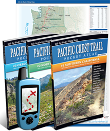
@Jeff: Right now I’m working on updating the Pacific Crest Trail Atlas. Once that is done the John Muir Trail Atlas will be next up. So sometime in the next year or two. The next edition of the JMT Atlas will be mostly a cosmetic update since the information in the first edition is still mostly current.
Erik, thanks for the detailed trip report and photos! I’ll be on the TRT this fall (late September) so really appreciate all the details. I used your JMT Pocket Atlas and loved it. Really wishing your TRT guide would be ready by this fall… Thanks for all the great information you put out in your blog. Carol
@Carol: Thanks, I’m glad to help and good luck on your trip. There is an off chance that I might have the TRT Atlas ready by fall. Once I get the first couple of PCT books out the door I might switch gears and work on the TRT for a while. If so I will let you know.
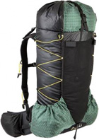
What pack did you use?
@Ryan: My pack is a ULA Conduit, which is the older version of the Ultralight Adventure Equipment CDT. It weighs 21 ounces.
Thanks everyone for your help and comments. It appears like the trail is well signed and resupply is easy. Hopefully the snow will clear early. I am going to do the JMT in August, but was looking for a second trip earlier in the summer.
If TRT isn’t clear in June, are then any other thru-hikes about the same distance that anyone can recommend?
Thanks!
ETB, Will you be coming out with your TRT atlas before middle of July ? We (me and the Woodrose) plan to start walking north from HWY 50 (Echo Lake) 18 July, doing the TRT clockwise. Next sobo on the PCT heading for JMT via Hetch Hetchy, finishing Mt. Whitney late September. We already have your Central California PCT Atlas…..(all the book and maps we need, except for Yo Valley and HHetchy). All Best, Muleskinner, walkin’ with Medicare for the first time this summer.
@Muleskinner: Unfortunately the TRT Atlas will probably not be available before July. Most likely it will ready be this fall or next spring. I’m working on finishing up the first couple volumes of the 3rd Edition PCT Atlas first.
My wife and I are planning on doing this trail sometime in July. What temperature rated sleeping bag would you recommend? This will be our first long backpacking trip. Do you have any tips for this hike? Thanks for the Backpacking gear planner. Its been a huge asset, especially when trying to limit weight! Thanks
@Derreck: For July you could probaby get away with a bag rated 30-40 degrees. But since sleeping bags are so expensive you might want to buy just one bag that will work for all your spring, summer and fall hikes that is rated around 20 degrees and unzip it and use it like a quilt in the warmer summer months. That’s what I do with mine.
@Susan P: I would agree with Erik that the best hiking season for the TRT is between late June and early October. Just know that even in a relatively smaller snow year (like the current winter) you will definitely still hit plenty of snow in the Desolation Wilderness area. Snow often lingers there through July, and in heavy snow years like last winter, snow will linger in patches throughout the entire summer. Personally, September is my favorite month for hiking in Tahoe because most the lakes are warm enough to swim in, and the crowds are half what they are in July and August.
@Erik: We just said hi in passing. I didnt put the black clothing and beard together as you until we had passed each other. But yea, on our TYT hike we went 6 days without seeing anyone outside of our group on the trail; which was half of the total days! The trail definitely felt very remote and little traveled; which I guess is why the forrest service has given up maintaining the trail, meaning there are two cross country segments now. I highly recommend the trail though.
Erik, I also just wanted to say thanks for maintaining such an informative hiking blog. I am leaving on my first ultra long distance thru hike in two weeks, and your blog/books have been an invaluable resource in my planning. Can’t wait to hit the trail again!! PCT 2012.
when is the best time to go? is June too early, or is there still a lot of snow? also, getting there & away – what is the nearest or best logistical airport and land transportation to take to THs?
Thanks!
@Susan P: Oops, missed your question about getting to the trail. The nearest major airport is in Reno, NV (about 60 miles away). The North Lake Tahoe Express Shuttle can take you from the airport to the Lake Tahoe area. If you are driving to the trail you can park at one of the many trailheads and you’ll finish right back at your car (which is very convenient). I have heard some stories about cars being broken into at trailheads, but nobody messed with ours.
Hi Erik, great pictures! We’re planning a thru hike of the TRT in July possibly starting from Mt. Rose with resupplies at Tramway Market, Echo Lake and Tahoe City. We won’t have a car so we’ll be using shuttles and cabs to get from Reno to wherever in the north to the trailhead. Any ideas for cheap lodging in the north? Alternatively, we could stay in South lake Tahoe, but then we’d have a long dry stretch between Tahoe City and Kingsbury. Any advice on lodging or a way to break up that section would be welcome. Thanks! We can’t wait for the pocket guide!
@September: Starting at Mount Rose would be nice since you would start your hike on one of the most scenic and easiest sections of the TRT. That is how I plan to do it next time I go. You could spend the night in Tahoe City (if I remember correctly it was about $80 for a hotel) and take the TART Mainline bus to Incline Village. From there it should be a pretty easy 9-mile hitch up Highway 431 to Mount Rose Trailhead (there is a ton of day-hiker traffic heading out to that very popular trailhead). You could also start in South Lake Tahoe if you like. The Water situation on the north side of the lake is not as bad as it appears. There are quite a few seasonal water sources, a handful of reliable water sources close to the trail and several backup water sources which you can access by hiking a mile or two off-trail. You will be able to find water one way or another. All of the on-trail and off-trail water sources (that I know of) will be shown in the atlas.
Gotta love the Rim Trail!! Maybe I’m slightly biased because I was born and raised in Tahoe City, but I feel its definitely worth checking out for anyone who loves backpacking. Ive got countless hundreds of miles on it, and it NEVER gets old!
Kinda random, but my buddies and I saw you on the trail this fall near Echo Lakes hiking in the opposite direction as us. We were beginning our third day of thru hiking the Tahoe-Yosemite Trail, which shares the same route in that area. The TYT was such an amazing trail, and way more remote than anything Ive ever hiked. Any chance you will ever make a TYT atlas? There is little to no information about the TYT, and a book like yours would have made the trip planning so much easier.
@Dave: Cool! Did we meet or just pass each other on the trail? I haven’t done the Tahoe Yosemite Trail yet but it’s one I definitely would like to do. I’ve got to finish the new PCT Atlases and then the Tahoe Rim Trail Atlas first (which will be coming later this year and early next year). Did you see a lot of other hikers on the TYT (the portions that don’t coincide with the TRT or PCT) or did you have the trail pretty much to yourselves?
@Susan P: Dave might be able to give you a more definitive answer about the weather around Tahoe since he lives there, but I think the best time to go is between late June and early October. Depending on how much snow fell the previous winter you might encounter some lingering snowfields if you start in June, and if you run too late into the fall you might hit bad weather. I did it in September and the weather was great (except a few cold rain showers that luckily didn’t last long).
By the way, for anyone planning to hike the TRT something fun to do on your day off in Tahoe City is to raft the Truckee River. I’ve done this four or five times in the last few years and it’s always a blast. You can rent a raft or just buy a tube from the gas station. It’s a nice lazy river float (until the end where there are some minor rapids) and a fun way to relax and cool off and kill a couple of hours.
Did you just have one resupply? Are bear canisters required?
@Sean: I started at Kingsbury Grade (east side of the lake) and hiked clockwise. I bought some extra food at the little store at Echo Lake and then did a full resupply in Tahoe City.
If I had to do it over again I would start at Tahoe Meadows, pick up a maildrop at Echo Lake and then resupply in Tahoe City. This would break the trip into three nearly equal segments.
Bear canisters are not required as far as I know and I did not carry one.
Hi Erik, I will be going in July for a family reunion. Are there short hikes where I can take as a day trip. I am still not ready to do long hikes yet, just a novice.
@Sonia: There are trailheads with parking equally spaced around the trail about every 20 miles dividing the trail into 8 sections which make it convenient for shorter hikes.
The section between Tahoe Meadows and Spooner Summit on the northeast side of the lake is especially pretty with great views of the lake and easy terrain suitable for beginners.
The section between Echo Lake and Barker Pass on the southwest side of the lake (Desolation Wilderness) is even more stunning, but with more difficult terrain.
Those were my two favorite sections.
For anyone interested, there is a social network group on the TRT started by Mountain Education’s Ned Tibbits and found at http://groups.yahoo.com/group/TheTahoeRimTrail/
Out of curiosity how long did it take for you to do the complete trail? Also how did you manage to get away from work, etc.? Cool pics and great trip!! Thanks.
@Josh: It took about 10 days of actual hiking plus a couple days off in Tahoe City. Hiking and publishing books about hiking is what I do for work so that wasn’t a problem for me. But the good thing about the TRT is it’s short enough to do during a typical 2 week vacation. My friend Mark went with me and he has a normal job.