Pacific Crest Trail & John Muir Trail Pictures

The Pacific Crest Trail is a long-distance backpacking and hiking trail that runs 2,650 miles from Mexico to Canada through California, Oregon and Washington. I’ve hiked about 4,000 miles on the Pacific Crest Trail in the last six years, including a northbound thru-hike in ’07.
Here are some pictures from my PCT adventures…


Have any questions about the Pacific Crest Trail? Please post your comments below…
 My name is Erik Asorson, aka "Erik the Black." I'm a long-distance backpacker, cartographer and author of
Hi!
Going from Castella (I-5) to (I-80)SB soon. my conditioning not great (same as last year. Last year I-80 to Yosemmite (SB) 13 days, 16 miles per day. might I be OK conditioning wise?
Also any auto parking recommendations around Castella or Redding? Expect 25 days or more.
I am wanting to do the PCT for 2018 but have never been hiking. How would I prepare for this. I have had heart surgery 2011. But I am in decent shape just need to get into better shape. I would love to do this with my son. Any advice on preparing thanks in advance.
@Al: The best practice for hiking is hiking. Try to fit in as many day hikes and weekend hikes as you can between now and then. During the week, or if you don’t live near any trails, you can do cardio exercises like stair/hill sprints, or walk on a treadmill on an incline with a full pack, or a stair climber. Any way that you can improve your cardiovascular endurance will help, but no matter what you do there is going to be an adaptation period for the first six weeks or so on the trail. That is where you’ll really get into good shape. The good news is that the first part of the PCT in Socal is relatively easy terrain wise, so it’s a good training ground.
Dude love your site. Not gonna call it my bible just yet but I’ve taken in a lot of your advice thus far for decision making. I do have a question that I cannot seem to find an answer for regarding PCT to JMT. I’m going northbound on the PCT and the break off to the non coinciding part(s) of the JMT. Did you do it this way? Did you go into Yosemite to camp? Did you need permits? I would like to do the whole of the JMT while I’m doing the PCT. Is this even possible? Any info you can give would be awesome!
@Daniel: The JMT diverges from the PCT in three sections. I’ll list them south to north since that is the way you plan on going:
1) Crabtree Meadows to Mount Whitney (~9 mi.) This is the last segment of the JMT and is not part of the PCT. Most PCT thru-hikers will do this as an out-and-back side trip. Mount Whitney is the highest peak in the lower US and it’s worth the trip. You will need a permit that could be added onto your thru-hiking permit (last time I checked.)
2) Devil’s Postpile to Thousand Island Lake (~15 miles.) This is in the middle of the JMT where the two trails split and then rejoin later. Most PCT thru-hikers will do the western (JMT) segment because it is more scenic.
3) Tuolumne Meadows to Yosemite Valley (~23 miles.) This is the first segment of the JMT and is not part of the PCT. Most PCT thru-hikers will not bother doing this section because it is pretty big detour. Yosemite is definitely worth the visit, if you will never be coming back that way again. But, if you can do that segment as a separate trip sometime in the future, that would be my choice. That way you can take the time to explore all of the different sites in Yosemite without having to stall your PCT thru-hike. If you do decide to hike into the Valley, the good news is you won’t have to hike back up to the PCT. You can take the YARTS bus back to Tuolumne Meadows and pick up where you left the PCT.
Happy trails!
Hi Erik!
Can you recommend any part of the PCT or John Muir for early to mid-October? Don’t mind cooler temperatures but would like to avoid heavy snow.
We did Goat Rocks Wilderness in Washington State late September last year and it was glorious.
Thank you – I’m a fan!
@Annie Marie: You can hike any part of the first 700 miles of the Pacific Crest Trail in Southern California. It is usually snow-free until Thanksgiving or later. Up north it’s gonna be more hit and miss. You might have clear weather or you might have snow. I don’t think I would want to be in the High Sierras in October. I know some people have done it, but the chance of bad weather is too great and it’s so remote I wouldn’t want to be out there in a storm unless you are used to that kind of thing. You could probably do some of the lower elevation sections of Northern California or Oregon without too much risk. Once you get above say 6,000 feet elevation the chance of snow and cold weather is usually gonna be higher. Washington is beautiful in the fall, and then one day it turns on a dime and winter blows in outta nowhere anytime between September and November. It’s hard to say. If you going to hike in the late fall, just be prepared and expect that you might get some snow. Carry slightly warmer clothes, maybe a little extra food and a GPS to aid in navigation if the trail gets covered up. Good luck.
Eric, thanks in a large degree to your wonderful website, I thru hiked the CT summer 2015. Thanks to your wonderful online advice and great map book and wall map.
I’m thinking about doing 4-6 month-longish section hikes over 3-4 years on the PCT to complete the PCT. I’d like to go the best time of year for each section. For desert, Sierras, NoCal, Oregon, and Washington, what time of year would you section hike each of these and would you NOBO or SOBO each section? Thanks for the help.
@Stuart: Do you mean 6-week long section hikes? Because you can hike the entire PCT in less than 6 months. I think the best time to do Southern California is early spring (I would start around March 1st.) You will encounter some snow in the mountains so you will need to be prepared for that (carry a GPS for navigation and some cold weather gear.) But I think the beautiful early spring weather in the lower elevation parts of SoCal more than makes up for it. We have been in the midst of a big-time drought in SoCal for several years now, so the winters in the mountains have been way milder than average with much less snowfall than usual. That’s not going to last forever, but it doesn’t seem to be turning around any time soon. So it’s the perfect opportunity for early-season hiking in SoCal. That is the section of the PCT I am most familiar with, since I live here. I would wait to start Central California until mid-July, that way you give the snow in the Sierras times to melt and the creek fords a little bit of time to settle down. Northern California and Oregon could be done in the summer. Washington is beautiful in the fall, but make sure you get outta there before the end of September, because it gets cold fast.
JMT Southbound Vs. Northbound. I have been trying for weeks to get my wilderness permit for southbound. I finally got one but its for the Lydell/ Tuolumme meadows trailhead. I will miss the whole first section unless I day hike sections of it. Or without a problem I can get a permit northbound that starts just south of Whitney with out a problem. the first resupply is a little problem though. I am open to your thoughts.
@Erik: Northbound is easier to get a permit. The southern section of the trail is steeper and higher elevation which makes it a little more difficult. The first on-trail resupply is halfway in at Muir Trail Ranch. But, you do have other resupply options before that if you don’t mind hiking extra miles and hitch-hiking to get there (Lone Pine, Independence, Big Pine, Bishop.) Another thing to consider is your plan for Mount Whitney. If you go north then Mt. Whitney becomes and out-and-back hike from Crabtree Meadows, which adds more miles to the first leg of the trip.
Southbound is difficult to get a permit and you would have to skip part of the trail if you can’t start at Happy Isles, as you mentioned. You will have to deal with crowds in Yosemite at the beginning of your hike. There are more on-trail resupply options sooner (Reds Meadow, VVR, then Muir Trail Ranch.) It’s a bit easier hiking the first few days (once you get the big climb out of the Valley behind you) which will be good for acclimating to altitude and getting your trail legs. You can finish your hike on the top of Mount Whitney and exit out Whitney Portal without re-tracing your steps (assuming you can get a permit for that.)
All things considered, I would go north myself. But that is just because I hate permit bureaucracy and that is the least complicated option. I would send a resupply bucket to Muir Trail Ranch and pack a few extra days of food. Enough to go up Mt. Whitney and back, and still make it to Muir Trail Ranch. If you end up going slower than you expected you still have the backup option of hiking down one of the side trails to the Owens Valley and resupplying in one of the towns there (although that does involve a lot of extra miles and hitch-hiking so I would avoid it if possible.)
Erik,
I got a northbound permit leaving from horseshoe meadow. The Yosemite bureaucracy is so nuts. Yes I would ease into the hike slower, but I have been looking at the trail from horseshoe to crabtree and it does not look so bad. That would be a good warm up. I have aloud myself an extra day to day hike up to the top of Whitney with a day pack. with a base camp at Guitar lake. Then from there go full throttle. I will have full access to Yosemite all the way to Happy Isle. Possible resupply at onion creek. I will day hike it with an empty backpack by setting up a camp at the JMT junction. I am in touch with the pack station there where they will hold a box for me so I don’t have to go all the way to Independence.
Does this sound thought out, and good planning/
@Erick: Sounds like a good plan to me. The hike up Cottonwood Pass Trail from Horseshoe Meadows is easy. It’s a quick, steep four miles. After that the PCT is pretty relaxed until you get to Whitney and Forester Pass so that should give you some time to warm up before hitting all the big passes. Have a great hike.
I’m doing that hike soon i hope just need get a insurance check i hope it comes b4 april! How long did it take you to hike from boarder to boarder?
@Jake: It took me 5 months, 5 days to hike from Mexico to Canada on the PCT.
Hi Erik,
As with everyone else, great website, very informative and appreciate all the time and effort you have put in not only posting the blogs but also in responding to so may comments! Thank you
I have a two part question, not sure of if applies here but I could not find an appropriate area.
1- I have read in your other responses about your “normal” morning routine. How or does it change when it is raining? Coming from a more traditional heavy load backpack and canoeing environment .. sometimes it was just a .. not getting out of the sleeping bag until it starts to let up. You observations on thru-walking when you “need” to get miles in?
2 – Packing up in the rain … if it is heavy .. everything is going to get wet. Any comments or “tricks of the trade”?
@Jim Arthur: I don’t like walking in the rain very much, so I avoid it if possible. If I’m on a leisurely trip and the weather get nasty I’ll happily stay inside the tent reading and sipping hot drinks until it passes 🙂 But, if you gotta hike in the rain because you are somewhere that is rains constantly, or you have limited supplies and have to make miles, I think the most important thing is to stay warm (as opposed to staying dry). Getting wet isn’t really that dangerous as long as your body’s core temperature is warm. I try to be very diligent about keeping my sleeping bag and insulating clothing bone dry (by storing them inside fully waterproof dry sacks and then being careful when transferring them from one place to another.) If it’s raining in the morning I’ll pack up everything under the tent or tarp before getting out, and when coming into camp at night the tent goes up first before anything else comes out of the pack. When it comes to keeping gear dry, an ounce of prevention is worth a pound of cure in my opinion.
How much food do you start with and after each resupply and how long does that usually last you?
@Roberto: It depends on the distance to the next resupply and how quickly you hike it. On the Pacific Crest Trail it’s usually 5-7 days per stretch. I carry 2-3 pounds of food per day and try to select foods that will provide at least 4,000 calories/day.
Your pictures are gorgeous!
hi
Incredible blog!!!
I trying to organize the full trip and I have some questions…
how long take normally and how many milles should I walk daily?? When its the best time to start??
do any need special knowledge of snow hicking , could be dangerous for a normal person??
thanks
Adrian
@Adrian: It takes about 5 months to hike the entire Pacific Crest Trail at an average pace of 20 miles per day. Most hikers do the trail from south to north. The best time to start a northbound thru-hike is in late April. Depending on how much snow fell the previous year there may be deep snow-pack in the High Sierra requiring an ice axe and crampons, but usually they are not necessary. If you do not finish your hike by mid September you may encounter snowstorms in Washington in the fall.
Hey Erik!
You have some awesome photos. I am going to try northbound thru hike! Could I possibly use some of your photos for my blog?? They’re awesome.
-Joe
@Joe: No, you may not use my photos.
Wonderful photos. What are your favorite sections that allow dogs? I’ve been backpacking since I was a little kid but am just starting to get into long-distance multi-day hikes (v destination pack trips). I want to do a long trip next summer but am trying to figure out where. I’d love to get a tip from someone who has done the entire PCT.
@Sierra: I’m not sure of the specific regulations regarding dogs in all of the different jurisdictions on the Pacific Crest Trail. I know that dogs are allowed on the majority of the trail and prohibited in some areas (like Sequoia Kings Canyon and Yosemite National Park). My two favorite sections of the PCT are the John Muir Trail in Central California (where dogs are not allowed) and most of the state of Washington.
Erik,
I’m starting to rough out a plan for a thru-hike of the Oregon portion of the PCT. What would you suggest for the timing on this hike i.e. time of year, north to south. also, incredible pics and thanks for all the great info!!
@Randy: I would plan to take 4-6 weeks to hike the Oregon part of the PCT depending on how many miles you want to do per day. The best time to go would be between early July and late September. Most thru-hikers pass through Oregon in August going northbound. If you want some company with other hikers you could hike around the same time. Otherwise northbound or southbound are both just as good. Oregon is one of the easiest segments of the PCT (not a lot of steep climbs) so you can do big miles if you want without a whole lot of fatigue.
Happy trails!
Hey Erik! I saw the pics of your dog – so cute! My husband and I are planning a 4 day backpack on part of the Washington PCT this summer (we’ve never done more than one night so we’re stepping it up a bit). We want to take our dogs with us but were wondering what special things we have to keep in mind for them. Will wildlife be a problem with them?; do they need to sleep in a tent?; how far can we expect them to go in a day? They are in great shape but the older one is about 8. How much water/food should we plan for them? Thanks!
@Katie: Here is what I bring for my dog when we go hiking together:
– His backpack (which holds his food, water and other doggie gear)
– Leash
– 30′ parachute cord (for tying him up if I need to)
– Collapsible food and water bowls
– Ball (he likes to fetch)
My dog Jake (4 year old German Shepherd) can hike as many miles in a day as I can, but he gets tired as the days wear on. I only bring him on hikes that are 5 days or less because after that he gets grumpy.
I sleep outside under a tarp and my dog sleeps nearby. As long as it’s not too cold at night they should be fine sleeping outside. If your dogs are well trained it will make your life easier. If not you might want to keep them on a leash or tie him up at night so they don’t get distracted by a coyote or something else and run off. My dog likes to chase coyotes and even elk (one time he herded half a dozen elk around a meadow for about ten minutes until I called him back) but he is a shepherd so that’s what he likes to do, and he comes back whenever I call him.
If your dogs are smaller you might be wary of coyotes. Sometimes they will send a lone coyote (often a female) out to lure your dog away and then the whole pack will ambush him.
Since I only bring Jake for few-day long hike I bring the normal amount of food he eats (dry food) plus a little extra and he carries it in his own pack. If there are not a lot of natural water sources I pack as much water for him as for myself (1 quart for 5-10 miles depending on how hot it is). He carries his own water in his pack.
If the terrain is rocky some dogs get sore feet. They make little doggie booties for that, but I’ve never tried them since Jake’s feet seem to hold up OK.
Have a great hike!
Hey Erik.
A friend is looking to do backpack 5 days on the PCT this summer. Any sections you suggest/tips/resources for planning I could share with her.
Thanks!
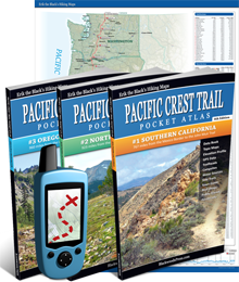
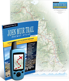
@R: Does your friend have a particular state or area on the PCT in mind? It’s a big trail with lots of good spots and a few duds. My favorite sections are the High Sierras between Kennedy Meadows and Lake Tahoe in Central California and the Cascades in Washington. The part of the PCT that coincides with the John Muir Trail in the High Sierra is the one section most people would recommend you see if you have to pick just one spot to hike. It is the most impressive, beautiful, isolated and challenging. My Pacific Crest Trail Atlas guidebooks are currently sold out (making the transition to the upcoming 3rd editions) but my John Muir Trail Atlas guidebook is still available. It has maps for the entire JMT and information about access points and resupply stops along the way.
Hey Erik! I knew you from Maxforums. I just randomly came across your site and your photos are amazing! Congrats on the new business and for unplugging yourself from the Matrix and stepping into the “real” world. It’s inspiring.
Which part of the PCT is essentially snow and ice free throughout the entire year?
@Stephan: The Pacific Crest Trail in Southern California is typically snow free year-round except where it climbs up above 5,000 feet in a few different places:
1) The Laguna Mountains around Mount Laguna
2) The San Jacinto Mountains around Idyllwild
3) The San Bernardino Mountains around Big Bear
4) The San Gabriel Mountains around Wrightwood
5) The Southern Sierra Mountains around Kennedy Meadows
Since the trail in Southern California alternates between low elevation deserts and high elevation mountains (kind of like a roller coaster) it’s hard to string together a continuous hike in the winter without encountering snow. But you can do quite a bit of winter and early spring hiking in the valleys. Also, the snow typically does not start to fall in Southern California until around Thanksgiving, so you can usually hike well into the fall season snow free.
I am happy to report that the Section 9 avalanche, just before the Mojave Dam, has been cleared. Good Job Fire Crews
@Brad: Thanks for the update. Good news.
Just an update on Section 9. Just in the middle, if you were making your way north, just before the Mojave Dam, the trail is closed. There was a slight rock slide that has covered the trail. I was there Feb. 19th. I hiked through anyhow. It is passable but according to the signs and caution tape, the trail is closed.
Excellent pictures. I am looking for a trail camera. Any advice or recommendations?
@Stephan: I always use cheap (sub $200) point and shoot digital cameras because I’m not very careful and they always get ruined (dropped in a creek, dust in the lense, etc.). Been through half a dozen cameras in the past few years. My favorite brand for outdoor photography is Canon.
Erik – I am a photographer and also write a weekly column for The Coloradoan Newspaper in their Xplore Section called “On the trail”. Your pictures of the PCT are good and paint a nice picture of the beautiful scenery and challenging landscape on the trail. I am a day hiker thinking about becoming a backpacker. I have read your information and find it most helpful. Keep up the good work.
are dogs allowed on the entire PCT? i’d like to make a run at a hike through and i’d love to take my pack dog with me.
@Brad: There are a few spots on the PCT where dogs are not allowed, like In Yosemite. But dogs are allowed on the majority of the trail. Some people have thru-hiked the PCT with their dogs. They either skip the parts where dogs aren’t allowed or sneak them through. I only take my dog on section hikes. He doesn’t like to hike for more than a week at a time and hiking with a dog complicates the process of going into towns to resupply.
I’m taking my husky (Kai) on our first shakedown hike from Rush Creek to Garnet Lake. Wanted to do the Postpile to Toulumne Meadows but I ran into same problem with Yosemite and their no doggy policy. I just ordered a Ruffwear pack for him. What do you take for your dog on a 4 day hike? BTW, ❤️ My new #3 pocket atlas! Great book, lots of great info.
After doing the P.C.T. in sections and seeing your great pictures, the memories that come back to me at each location are as precious as GOLD !
Beautiful photos Eric. Very inspiring…makes me want to be out there. Thank you for sharing
Awesome pics! Thanks for sharing
Bluejeans
Great photos, Eric! Thanks for all the inspiration & practical advice you provide. Lookin’ forward to the JMT in August.
I was going to complain about Oregon and Cali not getting represented now so that we could talk you into even more pics. I guess I will just have to hike it myself to see.
Thanks for sharing.
beautiful. inspiring.
Ok, by popular demand I’ve added more Washington 😉 The bottom 12 rows are all Washington now.
@Bruce: I hike solo and with friends. In a group I usually break away and go at my own pace and we’ll meet back up at breaks and in camp.
Hey EB do you hike alone?
What Happened to Washington!! I got to agree with Serpent Slayer. 😀 You were probably so fast by then that it just flew by! 🙂 Great first post, now where’s the rest?? 90 pics, come on we know you took at least a couple hundred!
By the way how long do it take you this time? I am so jealous of your life style!! I am working on being able to do longer hikes, but not quite there yet.
Wolfman
Great, great, great! I am so inspired…
Eric those are amazing pictures! You’ve a real eye for framing your pictures well and capturing all the beauty that is the PCT. You r knowledge and inspiration made my 2011 nobo hike possible. Cheers!
@No Knees: Thanks a lot and congrats on your hike!
Hey EB, Nice photos, but you need more Washington in there. I mean really…shirking on WA pics, that’s like no hot fudge on a hot fudge sundae. 🙂
@Serpent Slayer: I know, Washington has some of my favorite parts of the trail outside of the Sierra. Unfortunately it’s so dang rainy sometimes I don’t want to take my camera out.